Near Haverstraw
Rockland County,
New York
Hiking Trails:
Long Path: Green blaze
Low Tor Trail: White blaze
Total Time: 1:00 hour
Estimated Distance: 2.5 miles
Level of Difficulty: Easy
Level of Recommendation: Recommended
Points Of Interest: Easy hike to good view
Google Map of Parking:
View 2012 Hiking in a larger map
Low Tor offers a good view of the Haverstraw area. It is on the Palisades Sill, and is the smaller brother of High Tor, which is the highest point on the Palisades, and about a mile or two west of Low Tor. While High Tor affords a more rugged and steep climb, the Low Tor hike from South Central Highway is very and level, except for a small part that climbs up at the end. Low Tor sticks out about 200 feet from the surrounding ridge, and its northern side is almost a sheet cliff about 600 feet above.
We parked in the parking area on South Central Highway on top of the mountain, and took the Long Path down and continued along past the power lines. The Long Path in this area is in fact a very wide trail with very easy elevation grade. At the intersection of the Low Tor Trail, the trail steeply climbs for a short while to the top.
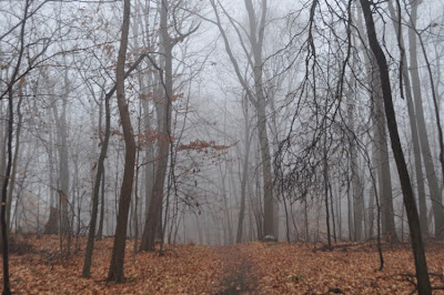
This was a very foggy day with very poor visibility. We got to the view and could see absolutely nothing. It was a very eerie feeling with such intense fog, especially with the recent graffiti painted over some rocks and trees on the Long Path.
 |
| Map of the Route |
 |
| Walking along the Long Path |
 |
| Shimmy at the Viewless View |
 |
| Climb to the top of Little Tor |
 |
| Me in the fog at the view. Note the cliff edge behind me. |
 |
| Another view of me in the fog. |
Love your blog! Thanks for the info!
ReplyDelete