New York
Hiking Trails:
Pine Meadow Trail: Red blaze
Suffern-Bear Mountain Trail: Yellow blaze
Sherwood Path: Unblazed
Total Time: 2:00 hour
Estimated Distance: 4.2 miles
Level of Difficulty: Slightly difficult
Level of Recommendation: Recommended
Points Of Interest: Catamount Mountain View
Pros: Quiet area of the park, good climb, good view
Cons: Power line and gas line detract from natural setting
Google Map of Parking:
View 2013 Hiking Locations in a larger map
The weather on this hike was quite a contrast to last week. It was in the 90's and oppresingly humid, though I figured I would be in the shade for the most part and there would be a breeze. I parked at the Horse Stables at Ramapo Equestrian Center off Route 202, and took the Pine Meadow Trail as it climbs the mountain through a notch with a stream. At the junction with the Suffern-Bear Mountain Trail I took a right and headed on the joint Pine Meadow and Suffern-Bear Mountain Trail. From there I split off to the Suffern-Bear Mountain trail to the excellent view here. Note that this view is missing from the NY/NJ Trail conference maps). I then headed towards the Sherwood Path, which is an unmarked trail road, and I took this trail back down the mountain. From there I followed the trail of the Gas Line back to my car.
 |
| Map of the Route |
 |
| The Pine Meadow Trail near the beginning, near the Power Line |
 |
| Small Cascade along the edge of the Pine Meadow Trail |
 |
| Ant Eating a Caterpillar. |
 |
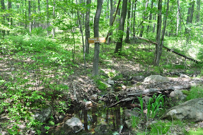
| Pittsbollow Hollow Brook. This is where the yellow trail and red trail split. |
 |
| View from the viewpoint. Facing east. |
 |
| Another view from viewpoint. Facing South |
 |
| Another view shot, facing south. |
 |
| Facing south towards Cobus Mountain |
 |
| At the view, facing northwest |
 |
| Shelter at Sherwood Path and SBM Trail. |
No comments:
Post a Comment