Bear Mountain State Park/
Harriman State Park,
Rockland Co.,
New York
Hiking Trails:
Cornell Mine Trail: Blue blaze
Ramapo-Dunderberg Trail: Red blaze
1777 Trail: Red blaze
1777 Trail E: White blaze
Total Time: 2:45 Hours
Estimated Distance: 5.3 Miles
Level of Difficulty: Difficult
Level of Recommendation: Highly Recommended
Points of Interest: Good climb and Excellent View
Hiking Partner:
Shimmy Rosenberg
This hike is one of my favorites in the Harriman/Bear Mountain area. The area is quiet, the scenery is dramatic, the climb is steep, and the view is excellent. The Gran Fondo bike race was this same Sunday, and their route was right where the trailhead was. We parked on Route 9W right before the road to Bear Mountain to avoid the traffic from the bike race, and then walked down a little bit to the trailhead. It was difficult crossing Route 9W due to all the bikes going in both directions.
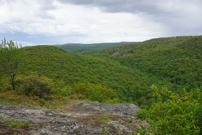
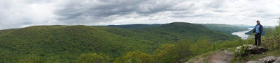
We took the Cornell Mine Trail from its beginning, and climbed up along the brook on the ridge. We continued along on this trail until its steep ascent. Where the trail turns west on the climb, we stayed straight and took the original steep trail route up back to where it meets the Cornell Mine Trail again. We took the Cornell Mine Trail until its terminus on Dunderberg Mountain, by a small pit that is part of the Cornell Mine complex. We headed west on the Ramapo-Dunderberg Trail to its short traverse to the summit of Bald Mountain, which is really the western part of Dunderberg. This area affords an excellent and unobstructed view north, west, and south.
From the Bald Mountain view, we continued along the Ramapo-Dunderberg Trail down into the valley, and cut across on the unmarked woods road that goes in to Pleasant Valley Road in Doodletown. At this point, a small storm rolled in, with strong winds and rain, making the conditions very uncomfortable. About 20 minutes later the rain and wind died down, and we continued along the path until it met up with the 1777 Trail at the end of Doodletown.
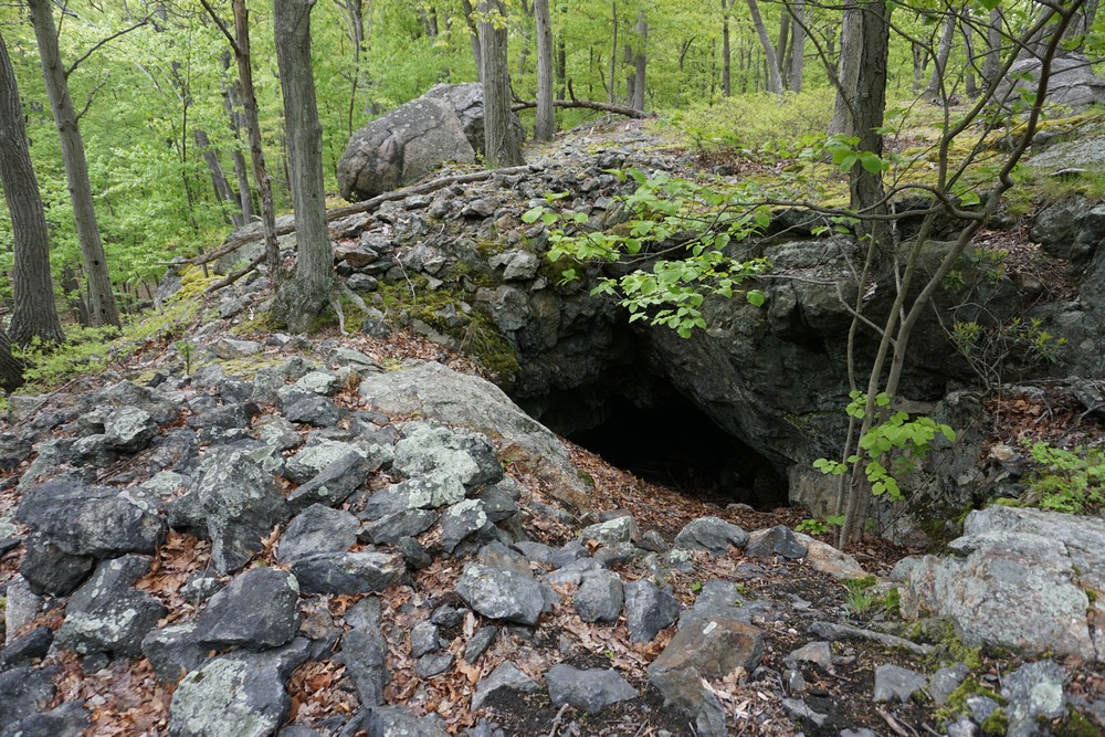
Doodletown is a ghost town. This was a small community up until the 60’s, when the state purchased the entire area and made it into a state park. Although none of the structures are preserved, many of the foundations are still in place, and plaques are placed throughout the area describing all the former structures, such as the homes, schools, and church. We went along the trail and veered off at the first former unnamed road that goes to the east and loops back around south towards the Edison Mine. We quickly went up the hill to explore the Edison Mine, went back down along the same road behind the Doodletown Reservoir, and then joined along with the 1777 W Trail briefly. We then took Pleasant Valley Road down back to Route 9W and our car.
 |
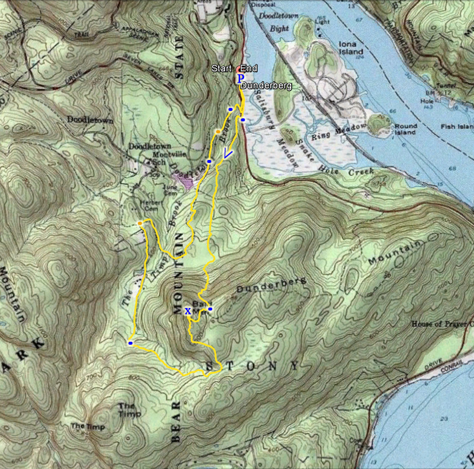
Map of the Route
Harriman/Bear Mnt Trails Northern Map |
 |
| Dunderberg Mountain from Beyond the Iona Island Swamp, From the Parking Area on 9W |
 |
| The Bear Mountain Bridge and Anthony's Nose, From the Parking Area on 9W |
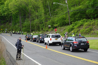 |
| Shimmy Posing with the Gran Fondo Bikers |
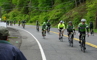 |
| Gran Fondo Bikers |
 |
| "The 16-footer" - Waterfall on the Cornell Mine Trail |
 |
| Approaching the Bald Mountain View, Facing North Zoomed Out |
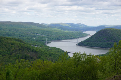 |
| Bear Mountain Bridge and the Hudson River from Bald Mountain |
 |
| Zoomed in to the Bear Mountain Bridge and the Hudson River from Bald Mountain |
 |
| View West from Bald Mountain |
 |
| Me at the Bald Mountain Summit |
 |
| Panorama of Bald Mountain Summit |
 |
| Me at the Bald Mountain Summit |
 |
| Descending the Mountain, with the NYC Skyline in the Distance |
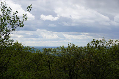 |
| NYC Skyline Beyond the Trees |
 |
| Zoomed into the NYC Skyline |
 |
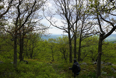
| Me Hiking in the Forest |
 |
| Bald Mountain from Doodletown |
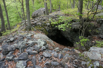 |
| Edison Mine Adit |
 |
| Caption at Doodletown Ruin Stating Recent Vandalism |
 |
| Wildflowers in Bloom in Doodletown |


No comments:
Post a Comment