Harriman State Park,
Orange Co.,
New York
Hiking Trails:
Dunning Trail: Yellow blaze
Ramapo-Dunderberg Trail: Red blaze
Long Path: Green blaze
Total Time: 2:15 hour
Estimated Distance: 5.0 Miles
Pros: Great views and very scenic area, interesting rock formations
Cons: None
This hike is in my opinion the most scenic area of the park. The area from Black Rock Mountain, Hogencamp Mountain, and Surebridge Mountain contain sparse tree cover in an area with large bedrock exposures and interesting rock formations. It is always very pretty here, but during the fall foliage it is exceptionally beautiful.
I parked at the Lake Kanawauke Parking area, and walked along County Route 106 West towards Little Long Pond. At Little Long Pond, I went on to the little peninsula jutting out to the south of the road, for some nice lake pictures with the early foliage colors. I then went back and crossed the road, and took the old Hogencamp Settlement road parallel to the brook. There used to be an old mining village here and the old road s and foundations are still present. I then bushwacked up the steep embankment to a view at the southern end of Hogencamp Mountain, just south of the Dunning Trail. This area has a great view, and it's not shown on the Trail Conference Map. I then continued from here along a short unmarked trail to the Dunning Trail.
I took the Dunning Trail past the Bowling Rocks, which are a bunch of glacially positioned large rocks along a long stretch of exposed bedrock. I continued on the Dunning Trail to the Ramapo-Dunderberg Trail, which I took north past the Goldwaithe Memorial and then to ship rock. All along this area there are nice views and large rock exposures. I stopped for pictures and a short break at the incredible view at Hogencamp Mountain at the bend before descending down the mountain.
The next intersection at the descent of Hogencamp Mountain is known as "Times Square" for its confluence of three trails in one area. I took the Long Path South at this point, past "Cape Horn" to the Dunning Trail, which I took south past the Hogencamp Mine. I then cut across an old abandoned road down back to the main road, which I then took back to my car.
 |
| Map of the Route |
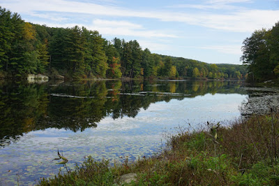 |
| Lake Kanawauke |
 |
| Lake Kanawauke at its Western End |
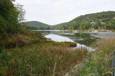 |
| Little Long Pond, Tom Jones Mountain (L), & Black Rock Mountain (R) |
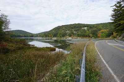 |
| LIttle Long Pond and Seven Lakes Drive |
 |
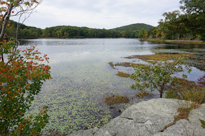
| Little Long Pond Island |
 |
| Little Long Pond Island from the Peninsula |
 |
| View from Little Long Pond Peninsula |
 |
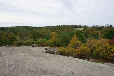
| View from the Southern Part of Hogencamp Mountain |
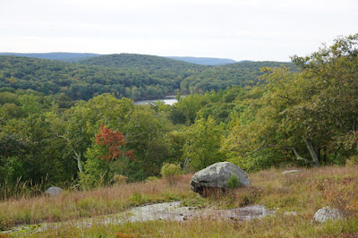 |
| At the Same View, Facing Towards Little Long Pond |
 |
| At the View at the Western End of Hogencamp Mountain, Facing East |
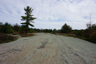 |
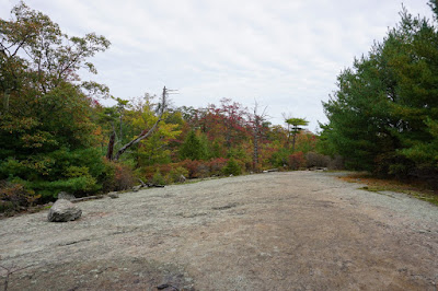
| Bowling Rocks |
 |
| Me at the Bowling Rocks |
 |
| Foliage at the Bowling Rocks |
 |
| The Bowling Rocks Formations |
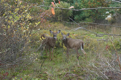 |
| Buck and Doe Staring me in the Face |
 |
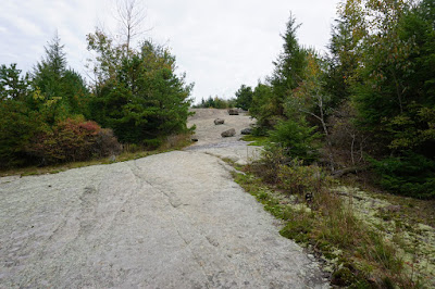
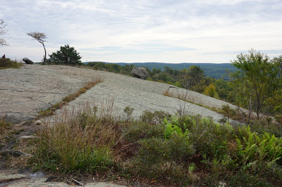
| Rock Exposures on the Ramapo-Dunderberg Trail |
 |
Large Rock Exposure on the Ramapo-Dunderberg Trail,
near the Goldwaithe Memorial |
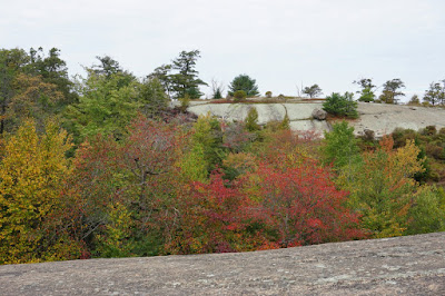 |
| Nice Foliage Looking Across Towards Surebridge Mountain |
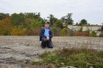 |
| Me at the Above View |
 |
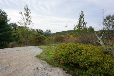
| Ramapo-Dunderberg Trail on an Exposed Rock Face |
 |
| More Pretty Scenery on the Ramapo-Dunderberg Trail |
 |
| Ramapo-Dunderberg Trail at the Intersection of the Lichen Trail |
 |
| Ship Rock |
 |
| Approaching the Hogencamp Mountain View |
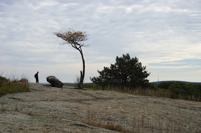 |
| Weird Tree at the Hogencamp Mountain View |
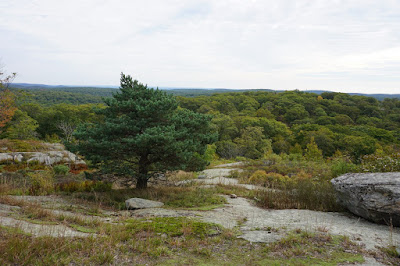 |
| View at the Hogencamp Mountain Summit |
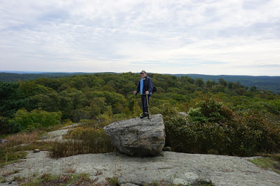 |
| Me on the Rock Atop Hogencamp Mountain |
 |
| Zoomed In |
 |
| View Before the Descent from Hogencamp Mountain |
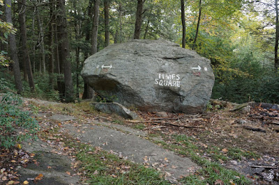 |
| Times Square in Harriman |
 |
| Hogencamp Mine Large and Deep Mining Pit |


No comments:
Post a Comment