Showing posts with label dater mountain. Show all posts

Sunday, January 5, 2025

Dater Mountain To Harriman

Dater Mountain County Park /
Harriman State Park
Rockland Co.
New York

Hiking Trails:
Orange Trail: Orange blaze
Kakiat Trail: White blaze
White Bar Trail: White blaze

Total Time: 1:35 hours
Estimated Distance: 2.8 Mile

Pros: Quiet, peaceful area
Cons: None
Hike Type: Two car hike
Level of Difficulty: Moderate

Hiking Partner:
Yehudah Koblick

Google Maps of Parking:
Car A: https://maps.app.goo.gl/z7iGz1bwgvdWFUQs5
Car B: https://maps.app.goo.gl/6dNZQPgHik9KqPRg7
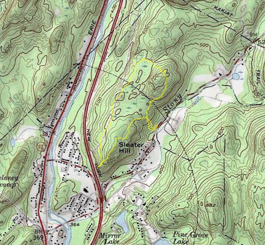
Map of the Route

Date Mountain Park Trail Map
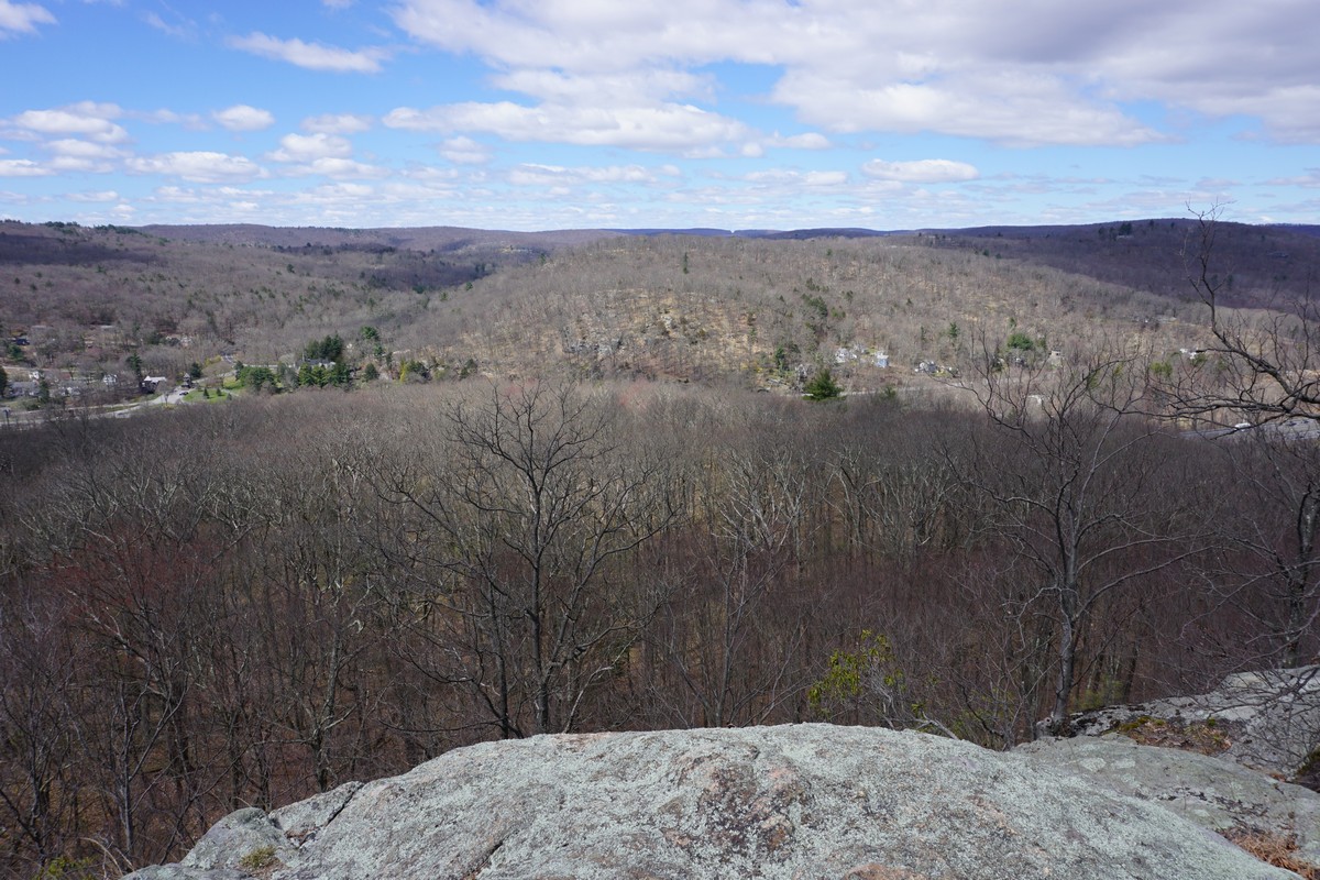
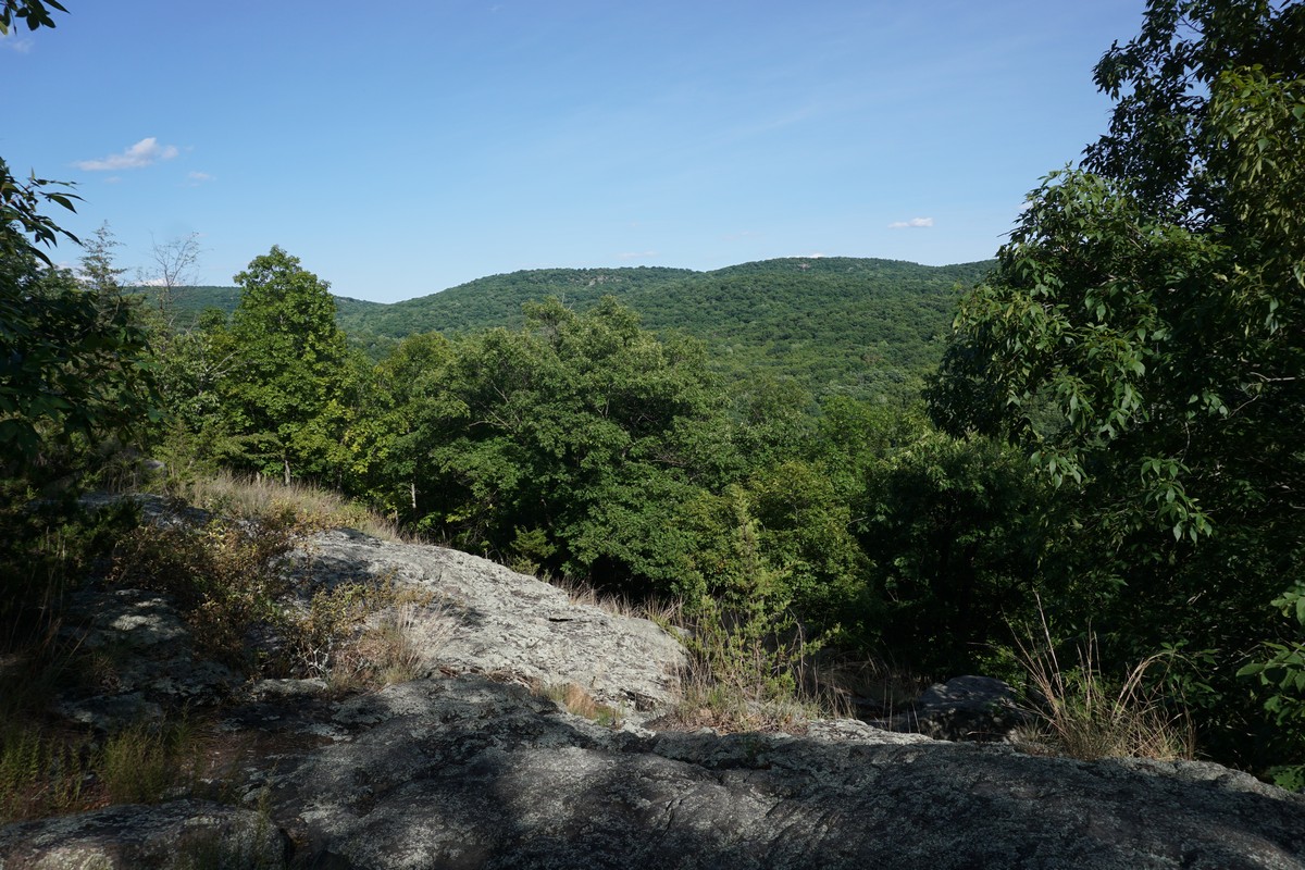
Dater Mountain View


Frozen Pond on Dater Mountain


Strange Sign along the Kakiat Trail. I did not see the Sasquatch. 

White Bar Trail

Sunday, April 7, 2024

Harriman State Park
Rockland / Orange Counties,
New York

Hiking Trails:
Blue Disc Trail: Blue blaze
Tuxedo-Mt. Ivy Trail: Red blaze
Ramapo-Dunderberg Trail: Red blaze

Total Time: 2:00 hours
Estimated Distance: 3.9 Mile

Pros: Good views, scenic and quiet area, rock formations
Cons: None
Hike Type: Two Car
Level of  Difficulty: Slightly difficult

Google Maps of Parking:
First Car: https://maps.app.goo.gl/bUyksxb3MernEToR8
Second Car: https://maps.app.goo.gl/bMLmNxV3ufS4tRKEA

Hiking Partner:
Yehudah Koblick

Map of the Route

Brook at the Beginning of the Hike

Ascending up Almost Perpendicular / Daters Mountain

View at Almost Perpendicular


Elbow Brush Rock Formation


Claudius Smith Den View


Smith Rock View Over Tuxedo


Monday, July 4, 2022

Dater Mountain Nature County Park July 4 Loop

Dater Mountain Nature County Park
Rockland Co.,
New York

Hiking Trails:
Orange Trail: Orange blaze
Blue Trail: Blue blaze

Total Time: 1:15 hours
Estimated Distance: 2.4 miles

Pros: Scenic and quiet area
Cons: Noise from highway and power lines
Hike Type: Loop
Level of Difficulty: Moderate

Google Maps of Parking:
https://goo.gl/maps/2sp4HnNkBJ7UFSRn7

Map of the Route

View of North Hill from the View


"Almost Perpendicular the Distance

Approaching Sleater Hill