Sunday, October 27, 2013

Nurian Trail to Boston Mine,
Harriman State Park

Orange Co.,
New York

Hiking Trails:

Nurian Trail: White blaze
Dunning Trail: Yellow blaze

Total Time: 3:00 hours
Estimated Distance: 6.0 miles
Level of Difficulty: Difficult
Level of Recommendation: Highly Recommended
Points Of Interest: Good climb, Remote Area, Historical Mine, Scenic Pond
Pros: Good climb, nice area, hardly-used area of the park
Cons: Trailhead doesn't exist, beginning of hike is too loud from the highway

Hiking Partners:
Eli Koegel

Google Map of Parking:

View 2013 Hiking Locations in a larger map

This was my first time doing this part of the Nurian Trail. I found the trailhead difficult to find because the map is incorrect and there aren't the symbolic three markers at the trailhead. I parked in the same parking area as the Southfields post office, and walked down a little street (Spring Street) to Railroad Ave. I then walked along the side of the railroad tracks north for a little bit until the trail came out of the right side. In retrospect I should have parked off the side of Route 17 north of Railroad Ave. since you can pick up the trail from there much easier without having to walk along the side of the tracks.

The Nurian Trail crosses the Ramapo River on an old bridge shortly thereafter, and then crosses over the busy Thruway on a pedestrian bridge. The trail then follows and old road parallel to the highway and then proceeds to climb the mountain. We climbed up and then back down to the Stahahe Brook Valley, and then ascending through the scenic "Valley of Boulders" up to a small viewpoint near Green Pond. At this point the Dunning Trail begins, but we continued along the Nurian Trail along its parallel course to the Dunning and when we hit the old mine road, we took the Dunning Trail to the Boston Mine.

The Boston Mine features a T-shaped cut with a large, water-filled hole going into the hill on one side. After the mine we bushwacked a short distance back to the road, and then took the Nurian Trail along the north side of Green Pond. This is a beatiful, natural pond that has beaver huts along the edges. There are small cliffs alongside the north and west side of it, where the trail go, making it particularly scenic, especially in the foliage. At the end of the trail it climbs up a hill to a nice view facing west. At this point we hit back to the Nurian Trail and took this same return route all the way back.


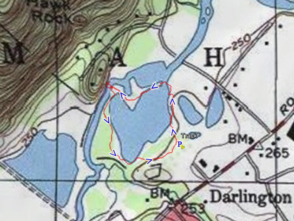
Map of the Route
Harriman State Park both Northern and Southern Maps

Crossing the Ramapo River

Pedestrian Bridge Across the Busy Thruway

Above the Thruway on the Pedestrian Bridge

Pretty Autumn Scene near Stahahe Brook.
Notice the Orange Boat cut in Half Towards the Right

Destruction Wrought by Hurricane Sandy,
Exactly One Year Ago

Entrance to the Boston Mine

The Main Hole of the Boston Mine

Green Pond Marsh Foliage

Green Swamp from the Dunning Trail, on the North Flank

Hill Along the Side of the Green Pond

Green Pond, View Taken from the West Side

Zoomed into a Beaver Hut in the Green Pond

Beautiful Red Blueberry Foliage

Ascending Towards the view

Sugar Maple Tree in Foliage

View at the End of the Dunning Trail. Facing West.

The Same View, Zoomed in More

View Facing Southwest

Mountains Behind the Trees at the End of the Dunning Trail

Tuesday, October 22, 2013

Samuel G Fisher Environmental Park

Mt. Ivy
Rockland Co.,
New York


Total Time: 0:45 hours
Estimated Distance: 2.0 miles (roundtrip)
Level of Difficulty: Very easy
Level of Recommendation: Recommended for a short and easy walk
Points Of Interest: Hike on old railroad bed through wetlands
Pros: Interesting wetlands
Cons: Confusing parking situation, follow same route back

Google Map of Parking:

View 2013 Hiking Locations in a larger map

This is a very easy hike through an old abandoned railroad bed through a wetlands area. There are often interesting birds to be seen here, and in the fall this made a nice foliage hike. The hike is short and very easy, with no elevation gain on a straight path. The trail is on an elevated grade above the swamp below, and is entirely straight throughout its duration. It starts off Pomona Road, and parking is at the parking area at the citizen's center. There are signs here stating parking here is only for the citizens residents, but I believe hikers/strollers are allowed to park here as well, and I did so. I do with they made this less confusing and designated hikers parking without the confusing signage. I walked down the trail all the way to the other end, where is hits a construction spot near Route 202, and then I turned around and walked back the same route.

Map of the Route

Entrance to the Park

Foliage Scene Along the Trail

More Foliage Scenes Walking Along the Trail

Foliage in the Swamp

Nice Reds and Greens

Marshy Area of the Minnesceongo Creek

Sunday, October 20, 2013

Long Mountain And Turkey Hill Lake

Harriman State Park
Orange Co.,
New York

Hiking Trails:
Long Path: Green blaze
Popolopen Gorge Trail: Red blaze
1779 Trail: Blue blaze

Total Time: 2:20 hours
Estimated Distance: 4.5 miles
Level of Difficulty: Slightly difficult
Level of Recommendation: Highly Recommended
Points Of Interest: Sweeping view atop Long Mountain, Turkey Hill Lake
Pros: Good climb, excellent view, and scenic lake
Cons: Path at the nd end of route overgrown

Hiking Partners:
Moshe Reich
Eli Shulman

Google Map of Parking:

View 2013 Hiking Locations in a larger map

This hike was at the peak of the autumn foliage. I made sure to do a hike with both good views and a pretty lake. We parked at the trailhead parking crescent on Route 6 where it meets the Long Path. We took the Long Path down to the valley, and at the intersection with the Gorge Trail, made a left on the woods road in the valley. Where that road hits the Long Path, we climbed up the mountain to the top, where the Torrey Memorial is. This part is a good climb. We then continued and climbed down the mountain on the other side, and at that same intersection we were at before, we took the Popolopen Gorge Trail all the way down to Turkey Hill Lake. The trail follows the southern part of the lake. After the dam we went on the woods road that connects to the 1779 Trail, and then took this trail past the public works area and then along a different woods road parallel to Route 6 but in the woods. This path has recently become very overgrown and is hard to follow. It is not recommended due to this. The woods road steadily climbs until it is right near the parking lot of Route 6.

Map of the Route.
Harriman/Bear Mountain State Park Northern Map.

View from Atop Long Mountain. Facing North.

Turkey Hill Lake From Atop Long Mountain.
Facing Southeast.

Me Atop Long Mountain, with the
Bear Mountain Plateau Behind me. Facing East.

Me Atop Long Mountain. Facing South.

Foliage Scenes Atop Long Mountain

Facing Southwest From Atop Long  Mountain.

Facing South from Atop Long Mountain.
Route 6 Cuts Across the Swamp in the Distance.

Approaching Turkey Hill Lake

Moshe Posing At Turkey Hill Lake

Me at Turkey Hill Lake

Turkey Hill from Across Turkey Hill Lake

Long Mountain Intense Foliage Behind Turkey Hill Lake

Looking Towards the Outlet of Turkey Hill Lake

Ribbon Snake Sunning.

Thursday, October 17, 2013

Lake Henry,
Continental Soldiers Park

Mahwah,
Bergen Co.,
New Jersey

Hiking Trails:

Lake Henry Trail: Unblazed

Total Time: 0:25 hours
Estimated Distance: 1.0 mile

Level of Difficulty:
Very Easy
Level of Recommendation: Recommended
Points Of Interest: Tranquil Lake and pretty scenery
Pros: Quiet area and very pretty lake with lots of interesting waterfowl
Cons: Double-track path takes away from natural setting

Google Map of Parking:

View 2013 Hiking Locations in a larger map

This is a little-known trail in Mahwah, right across from Ramapo College. Although it was a weekday, a beautiful, upper-70's day in the fall called to me for a quick lunchtime hike.

This area is right next to Ramapo Mountain Reservation, which is more well-known, but is not connected to it and is separated by the Ramapo River. There is a new trail that was created surrounding Lake Henry, and it is a pretty path with nice scenery of the lake and the mountains behind the lake. Lake Henry forms from a spur of the Ramapo River, and seems to be a natural lake with no dam. At the far end of the lake there is a short path to the main artery of the Ramapo River, which runs behind the lake. There were several interesting species of waterfowl present when I was there, including swans and several types of ducks. There are two bridges, one crossing at the inlet and one crossing at the outlet of the lake. The trail starts behind the park and tennis courts, and the path is a complete loop around the lake.

Map of the Route

Map Kiosk at the Beginning of the Trail

Foliage at the Ramapo Mountains

Ramapo Mountains and Hawk Rock Behind Lake Henry

Lake Henry with Ramapo Mountains  and Hawk Rock

Ditto

From  the Eastern Side of the Lake

Lake Henry from the Western Swan,
with all Different Waterfowl Swimming Around

Swan in the Lake

Swan and Duck Together

Bridge Over the Outlet of the Lake

Outlet of the Lake

Stunning View  from Southern  Part of the Lake

Another View from the Southern Part of the Lake