Sunday, January 26, 2020

North & South Redoubt Highlands

Hudson Highlands State Park /
Garrison School Forest
Putnam Co.
New York

Hiking Trails:
Cannon Trail: Red blaze
Sloan Carriage Trail: Gray blaze

Total Time: 2:00 hour
Estimated Distance: 3.6 Miles

Pros: Very tranquil area
Cons: None

This is a little-known area with several trails and views. It's on the Hudson Highlands map set with a single isolate trail, but it turns it out this area is larger than I expected and there are several more trails here not listed on the map.

I parked in the small parking area on Snake Hill, and took the Cannon Trail alongside a steep hill on the side of a scenic ravine with a stream below. The trail then splits to a spur up North Redoubt, with a view on the top. This view isn't all that great but the spur is short so it wasn't a big deal. I went back down the spur to the main Cannon Trail. The first part of the hike is in Hudson Highlands State Park, and then the trail enters the Garrison School Forest, owned by the Garrison School District with several hiking trails. There is a information kiosk at the entrance to the forest.

I continued along the Cannon Trail to the top of South Redoubt. This area features a very good view of West Point and Storm King across the Hudson River. It was very windy up there so couldn't stay there long. I took the Sloan Carriage Trail from the viewpoint, looping around back to the Cannon Trail, which I then took the same return route. I had not met anyone on this hike, which is unusual for a Sunday morning, until I was near the end, where I met a fellow who asked me if I lost an outdoorsmans knife. I checked my Camelbak backpack and indeed it was missing, so I took the short spur up North Redoubt to retrieve my knife where he said he had left it. I then proceeded back the same route and then returned back to my car.

Map of the Route

Leftover Snow at the Beginning of the Hike

Hudson Highlands Entrance Plaque and Trailhead

Trail Climbing Along the Steep Ravine

Trail Split Marker at the South Redoubt Trail

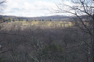
View of the Hudson from North Redoubt

View Facing East from the South Redoubt

Old Structure on the Trail along the Meadow

Entering Garrison School Forest

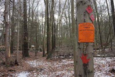
Signs at the Entrance of Garrison School Forest

Informational Plaque Along South Redoubt

View Across the Hudson from South Redoubt 
View of West Point and Storm King Mountain from South Redoubt


Another View of West Point

View of the Gorge Between the Hudson

Me at the South Redoubt View


Monday, January 20, 2020

Wekiwa Springs to Sand Lake

Wekiwa Springs State Park
Apopka,
Orange Co.
Florida

Hiking Trails:
Wet to Dry Nature Trail
Champion Sand Pine Trail (Orange blaze)
Sand Lake Trail

Total Time: 2:00 hour
Estimated Distance: 4.7 Miles

Pros: Scenic area
Cons: No elevation gain, parking fee

I was in Orlando for a short vacation, and decided to get away from all the people and tourists for a quiet spot in the subtropical Florida forest. I did a Google search and found Wekiwa Springs, a large state park with many trails and quiet areas.

Luckily the weather was cooler than usual, in the lower 60's, but still bright and sunny. This was ideal for hiking in short sleeves, but kept the crowds away from the spring and swimming area which can make this area very busy. Wekiwa Spring is a natural spring for fresh, crystal clear water that is ideal for swimming and boating. It was very quiet when we came, on a relatively cool weekday.

I parked in the main parking area, and took the Wet to Dry Nature Trail at the spring over boardwalk planks through a saw palmetto forest. I then took this short trail to the Champion Sand Pine Trail, going through different types of forest and flora. I took this to the Sand Lake Trail, which loops around a small Florida pond with warning signs of alligators present. I looked out for alligators but did not see any present. I took the same route back to my car in the parking area on the return route.

Map of the Route

Entrance to the Hiking Trail

On the Trail down to the Spring

Wekiwa Springs

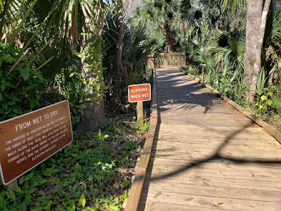
Wet to Dry Trail Boardwalk

Me on the Wet to Dry Trail Boardwalk

Champion Sand Mine Trail

Me on the Champion Sand Mine Trail

Alligator Caution Sign by Sand Lake

Me at the Alligator Caution Sign by Sand Lake

Sand Lake with Alligator Warning

Sand Lake

Me at Sand Lake

Another View of Sand Lake

Interesting Flora Along the Champion Sand Mine Trail

Sunday, January 12, 2020

Army Tunnels at Blauvelt State Park

Blauvelt State Park,
Clausland Mountain County Park,
Nike Overlook Park,
Tackamack Park,
Nyack/Piermont
Rockland Co.
New York

Hiking Trails:
Long Path: Green blaze
Red Trail: Red blaze
White Trail: White blaze
Orange Trail: Orange blaze

Total Time: 2:15 hour
Estimated Distance: 4.1 Miles

Pros: Exploration of old tunnels
Cons: Not many good views

Hiking Partners:
Shimmy Rosenberg

I had heard about the Army Tunnels at Blauvelt State Park for some time, and despite it being relatively close by, I had never been there. I took the opportunity to visit them with my partner Shimmy Rosenberg on this very warm winter day.

This is not the type of place you want to go alone. It's very creepy, even in full daylight. Aside from being entirely covered in graffiti, the walls, tunnels, and adjacent structures are somewhat dilapidated and full of beer cans and bottles. Despite this, the nature of these tunnels and our desire for exploration made this a very memorable hike. I would strongly recommend going in daylight, with at least one other person, and bringing a flashlight.

This was the warmest day of the winter so far. With temperatures in the mid-60's, we hiked in short sleeve T-shirts and really enjoyed being outdoors. Though there was a strong breeze, especially at some of the higher elevations. We used two cars for this hike. The first car we parked at Nike Overlook Park, and then we drove to the second starting point on Tweed Blvd. where it crosses the Long Path. There is a small parking spot here on the side of the road for about 1 or 2 cars.

We took the Long Path for a short distance north, to the view. This view faces southwest looking into southern Rockland County and northern New Jersey, with the Manhattan skyscrapers visible in the distance. After this, we took thr short Red Trail to the White Trail, back to the Long Path, which we took south for a short distance to the old firing range. We went to the target wall and tunnels on the eastern side first, exploring the area and then entering the tunnel. We walked through the entire length of the tunnel. I had a flashlight in my back, which helped illuminate our walk. The tunnel is not pitch black - there are cracks of light throughout, but it is still very dark and should not be explored without a flashlight.

Near the west exit of the tunnel there is a large structure which is full of empty bottles and cans. You have to step through them to exit, and climb through an open break in the room with a makeshift ladder to exit. We did that, and then walked above the second tunnel to the west, exploring the area some more. At the end of those tunnels, we cut to the bike bath right nearby, and walked along the bike path until reaching the Long Path. We took the Long Path down towards Tackamack Park North, crossing the scenic stream, and then continued to Tackamack Park South. We then took the Orange Trail for a short distance to Nike Overlook Park, back to where our first car was parked.

Map of the Route

View at the Beginning of the Hike

Manhattan Skyline in the Distance, Facing South

At the View

Shimmy Overlooking the Target Walls

Approaching the Target Walls

Abandoned Structure Adjacent to the Target Walls

Target Walls

Me Inside the Army Tunnels

Entrance of the Army Tunnels

My Silhouette Inside the Army Tunnels

Large Room at the End of the Army Tunnel

Exit through the Wall Breach

Shimmy Exiting the Tunnels

Me at the Busted Tunnel Exit

View of Tunnels from Above

Shimmy at the Target Walls

Stream at Tackamack Park

Ruin at Nike Overlook Park