Sunday, April 29, 2012

Todd Trail Lookout

Ramapo Mountain State Forest,
Bergen County,
New Jersey

Trails:

Todd Trail: White blaze
Yellow Trail: Yellow blaze

Total Time:
1:10 hour
Estimated Distance: 2.1 Miles
Level of Difficulty: Moderate
Level of Recommendation: Recommended for a short hike
Points Of Interest: Viewpoint and tranquil pond

Hiking Partner:
Rachel Friedman

Ramapo Mountain State Forest,
Bergen County,
New Jersey

Trails:
Todd Trail: White blaze
Yellow Trail: Yellow blaze

Total Time: 1:10 hour
Estimated Distance: 2.1 Miles
Level of Difficulty: Moderate
Level of Recommendation: Recommended for a short hike
Points Of Interest: Viewpoint and tranquil pond

Hiking Partner:
Rachel Friedman

Google Maps of Parking:

View 2012 Hiking in a larger map

This trail is in a busy hiking area in the Ramapo Mountains of New Jersey. Though the parking area was full being a nice Sunday, the trail was very quiet. I parked on Skyline Drive near the top of the mountain, and took the Todd Trail slightly down the mountain along to the viewpoint. This viewpoint overlooks Oakland and the suburban sprawl further east. From the lookout headed back and then veered off on the Yellow Trail to Todd Lake. Todd Lake is a small yet very tranquil pond in the woods. It is full of Lily Pads and had more tadpoles in it than I have every seen before. After stopping at the pond we turned around and went back to the Todd Trail and headed back to our car.

Map of the Route

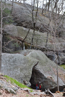
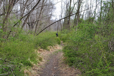
Approaching the Lookout on the Todd Trail

Lookout on the Todd Trail. Facing East.

Todd Lake

Monday, April 23, 2012

Pine Swamp Mountain

Harriman State Park,
Orange County,
New York

Trails:
Arden-Surebridge Trail: Red blaze
Long Path: Green blaze

Total Time: 0:45 hour
Estimated Distance: 1.2 Miles
Level of Difficulty: Easy
Level of Recommendation: Highly Recommended for a very short hike
Points Of Interest: Scenic Lake and viewpoint for a short hike

Hiking Partner:
Shimmy Rosenberg

Google Maps of Parking:

View 2012 Hiking in a larger map

There was a big rainstorm on the way - this was a late April Nor'Easter which was supposed to bring 3 to 5 inches of rain. In the morning it had not yet been raining, so we had opted to head out and do something short with an easy exit point. This was a good choice since a little more than halfway along the hike it started raining. We parked at the Lake Skanatati Parking area, climbed the short mountain on the Arden-Surebridge Trail, and went to the very famous Harriman view of Lake Skanatati and Kanawauke. From there we bushwacked down the side of the mountain along a deer path, down to the Long Path. From there we veered off the trail along the side of the lake along the network of paths that hug the side of the Lake. After we got to the car we took a short extension to look at the newly replaced bridge along 7 Lakes Drive between Lake Askoti and Lake Skanatati.

Map of the route.

Lake Skanatati at the parking area and near trailhead.

Viewpoint on Pine Swamp Mountain. Facing south.
Lake Skanatati is in the foreground and Lake Kanawauke in background.

Same view facing southwest.

Me at the view in my raingear.

Scenic Lake Skanatati

Beaver-felled tree. This is a fresh job.
I have never seen beavers here before at this lake.
They were probably recently introduced.

Another scenic view of Lake Skanatati

A fresh tree job from the beaver.

Shimmy along the brand new stretch of bridge connecting
Lake Skanatati to Lake Askoti.

Sunday, April 15, 2012

Appalachian Trail and Long Path

Harriman State Park,
Orange County,
New York

Trails:

Island Pond Road: Unblazed
Appalachian Trail: White blaze
Long Path: Green blaze
Arden-Surebridge Trail: Red blaze

Total Time: 2:30 hour
Estimated Distance: 5.5 Miles
Level of Difficulty: Difficult
Level of Recommendation: Highly Recommended
Points Of Interest: Scenic Lake, Rock Scramble, Good viewpoint, historical mine

Google Maps of Parking:


View 2012 Hiking in a larger map

This is one of the best, all-around hikes in Harriman state Park. It features all the best features of Harriman combined into one amazing hike! I parked the car on Arden Valley Road on the side of the road several hundred feet to the gated road to Island Pond. The road to Island Pond is locked and you can purchase a yearly pass from the State Park system, and this benefits mostly fisherman who want to go fishing in Island Pond. However, anyone can park on the pull-off on the side of the Arden Valley Road and hike to the pond.

After parking, I crossed the street and cut into the Island Pond Road, which took me to the Appalachian Trail right near Island Pond. Island Pond is a unique lake in Harriman in that it is entirely natural and not dammed like all the other large lakes in Harriman. I took the Appalachian Trail to the Lemon Squeezer, which is an interesting rock formation where you climb through a narrow notch within the rock, and partially climb up the mountain this way. Once I got past the Lemon Squeezer, I continued climbing. There is an excellent view right off the trail once you hit the top of the mountain (Island Pond Mountain), though you have to hike about 100 feet to the east off the trail and this view is not shown on any of the maps.

From the top of Island Pond Mountain started descending into the valley, where there is a well-marked intersection of two famous trails. The Appalachian Trail is perhaps the world's most famous hiking trail, and the Long Path is the most famous trail in New York State. The intersection contains a marker showing the distances of the trail terminus's for each of these enormous trails.

I continued along the Appalachian Trail and went along it as it descended towards the Greenwood Mine. The Greenwood Mine is an old historical iron mine from the 1800's, and you can see the cuts in the mountain here as well as extensive dumps and mounds of rocks from the old mining operations. The Greenwood Mine contains the most extensive dumps of all the old iron mines in the park. From the mine I veered off the trail onto the woods road that goes north from the mine parallel to the stream and along the side of a large swamp. This meets up with the Long Path, and I veered south onto the Long Path up the mountain, past the shelter, and along back to the intersection of the Appalachian Trail. From there continued straight along the Long Path, which goes along the side of a large swamp, and took this to the Arden Surebrige Trail, which I turned on to return passed the Lemon Squeezer and then the same route back to my car.

Map of the Route


The Entrance to the Lemon Squeezer

The Appalachian Trail through the Lemon Squeezer

Ascending the Lemon Squeezer

Island Pond from Island Pond Mountain.
Facing southwest.

Another view atop Island Pond Mountain. Facing West.

Southern view from Island

Signpost at the Junction of the Two Famous Trails:
The Appalachian Trail and the Long Path

Closeup of the Signpost.

Rock Pile in the Dumps of the Greenwood Mine

A flooded pit in the Greenwood mine

View from the Northern end of Surebridge Mountain. Facing north.


Tuesday, April 10, 2012

Duck Pond Mohonk Scramble

Mohonk Preserve,
Shawangunk Mountains,
Ulster County,
New York


Trails:

Glory Hill Trail: Blue blaze
Duck Pond Trail: Red blaze
Birchen Trail: Red blaze
Staircliff Path: Red blaze
Labyrinth Trail: Red blaze
Spring Path: Unmarked

Total Time: 3:45 hour
Estimated Distance: 5.1 Miles
Level of Difficulty: Very difficult
Level of Recommendation: Highly Recommended
Points Of Interest: Amazing Scrambling and views

Hiking Partners:
Shimmy Rosenberg
Morty Rosenberg


Google Maps of Parking:

View 2012 Hiking in a larger map

This was a highly scenic and strenuous hike. The Shawangunk Mountains represent some of the most amazing cliffs and dramatic scenery in New York State. We parked at the Pine Road parking area, which is a small remote parking area to the east of Mohonk Lake at the foot of the mountain. Note there is a self pay station for a hiking pass at the beginning of the hike where you are supposed to put $12 into an envelope. We took the unmarked trail straight, past Lenape Lane and past Catskill Aqueduct, to where it turns into the Glory Hill Trail. We then took the Glory Hill Trail until the Duck Pond, and from there took the Duck Pond Trail up the mountain. This trail goes through a deep ravine following along a stream (the Kleine Kill), steadily climbing up. The trail ends at a carriageway, with the perpendicular cliff of Sky Top looming above in the short distance.

From here we took the Birchen Trail up by way of maneuvering over large boulders to the Staircliff Path (the Birchen Trail turns into the Staircliff Path - the Staircliff path used to continue and then they closed it off). We scrambled along the Staircliff path through rock tunnels and crevices until the Labyrinth Trail, where we took this crazy trail with ladders and the requirement of tight squeezing to the top. We climbed the Sky Top Tower on top, where it was extremely windy, and took a lunch break there. We headed down the sky top path and then the off shoot with the steps to the Spring Path, and from there went back to the Staircliff Path and Birchen Path and took the same route back.

Map of the route

Ruin near the Beginning of the Hike

Duck Pond with Sky Top Cliff in the Background

Me and Morty Hiking along the Duck Pond Trail

Sky Top Cliff Looming Above, at beginning of Birchen Trail.

A Crevice where the Birchen Trail
turns into the Staircliff Path

Me Walking Through a Crevice on the Staircliff Path

About to go Inside a Rock Cave

Climbing Ladder Inside a Rock Cave

Scrambling Along the Side of the Cliff on the Staircliff Path

Morty on a rock


Starting My Ascent Through the Crevice

Me Almost Stuck Inside the Crevice

View from Sky Top.
Facing east.

Another View from Sky Top
Facing West-Southwest to Eagle Cliff and the Southern
End of Mohonk Lake

Me at the Top

Morty at the top with the Trapps Behind

The Trapps Through a Window in the Sky Top Tower

The Mohonk Mountain House as Viewed From the Tower Top.
Note the Catskill Peaks in the Distance.

Another Ruin near Duck Pond.
Shimmy and Morty Looking at a Geocache stored here.

View of Sky Top from the Distance on Butterville Road (after the hike)

Sunday, April 1, 2012

Buck Trail and Breakneck Pond

Harriman State Park,
Rockland County,
New York


Trails:
Unmarked Ski Paths: Unblazed
Buck Trail: Yellow blaze
Pine Meadow Road Trail: Unblazed

Total Time: 1:30 hour
Estimated Distance: 4.0 Miles
Level of Difficulty: Slightly difficult
Level of Recommendation: Recommended except for bushwack part
Points Of Interest: Tranquil and quiet trail

Google Maps of Parking:

View 2012 Hiking in a larger map

I parked at the Lake Sebago Boat Launch, and took the unmarked ski trail north. This trail is the old Johnstown Road again, which was eventually replaced with Seven Lakes Drive slightly to the east, though the trail remains on the original road. In a short while, the trail crosses the road, and then a bit further meets up with another unmarked trail that climbs Conklin Mountain to the Buck Trail. I took that trail up to the Buck Trail, and then took the Buck Trail north to its intersection with the northern spur of the Buck Trail. The northern spur is blazed yellow with a black stripe through it. Took the northern spur of the Buck Trail to its terminus at Pine Meadow Road.

At this point I decided to bushwack from Pine Meadow Road to the Breakneck Pond. This was a big mistake, even though it looks very close from the map. The route to the pond is very dense with thorns and evergreen rhododendrons, and this was extremely difficult. I also was traumatized when I found several ticks upon my jacket and pants once I was done the bushwack part, but luckily I was able to flick them. After bushwacking back to the Pine Meadow Road, I went down the mountain, and from there veered off the unmarked ski trail and then back to my car.

Map of the Route.

On the beginning of the Ski Trail,
on the old Johnstown Road.
Note the thorn briars with the new green leaves emerging.

A tombstone or monument, across 7 Lakes Drive on the Ski Trail

Intersection of the unmarked trail with the Ski Trail.
Its easy to miss, but you can find it by looking at the cairns and this fallen tree.
This unmarked trail is well marked with cairns.
Conklin Mountain is in the background.

Intersection of the Buck Trail with the northern Buck extension.
"The Buck Stops Here"

Breakneck Pond, from the southwestern shore.

Ditto, with the marsh growth visible.