Sunday, October 31, 2021

Cedar Swamp at Wawayanda Park

Wawayanda State Park
Sussex and Passaic Counties.,
New Jersey

Hiking Trails:
Cherry Ridge Road: Unblazed
Banker Trail: Green blaze
Cedar Swamp Trail: Blue blaze
Double Pond Trail: Yellow blaze

Total Time: 2:45 hour
Estimated Distance: 4.6 Miles

Pros: Very quiet natural area, scenic rhododendrons
Cons: No scenic views, parking and road to get there are difficult
Hike Type: Back and out
Level of Difficulty: Moderate

Google Maps of Parking:
https://goo.gl/maps/ibQQybBqZSQU4Aqw8

Hiking Partner:
Yehudah Koblick

The Cedar Swamp is a unique area in the highlands region with a non-coastal Cedar Grove in a mountain region. I had an infection on my foot and had to take it easy, so I opted for this hike which was supposed to be easy. However, a wrong turn in the beginning and an abundance of water from the recent soaking rains flooding the trails made this hike much more difficult than expected. I ended up returning home very sore with difficulty walking.

We parked at the end of the Cherry Ridge Road. The last part of this road is a dirt road that is in very rough condition. In fact, I considered turning around as the road deteriorated, but at last we made it to trailhead parking, where we met some bikers. We missed the beginning of the trail and ended up walking further on the trail part of Cherry Ridge Road, until we realized our mistake and turned around. We went back to the trail and this time correctly took the Banker Trail.

Part of the Banker Trail was flooded by a swamp outlet, and while skirting around the trail to avoid the water, I ended up slipping into the water and getting all wet. We continued to the Cedar Swamp Trail, crossing through beautiful, dense rhododendron forest, where it sometimes provided a canopy, and then reaching the boardwalk along Cedar Swamp. We the crossed the boardwalk, walked a bit more, then took the Double Pond Trail which we had intended to to take around as a loop trail. However, this trail was entirely flooded and impassible, so we had to turn back around and return the same way we came.
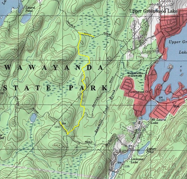
Map of the Route

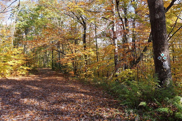
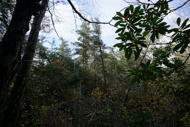
Cherry Ridge Road Foliage


Rhododendron Forest


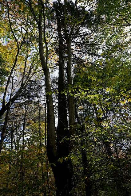
Two Intertwined Trees


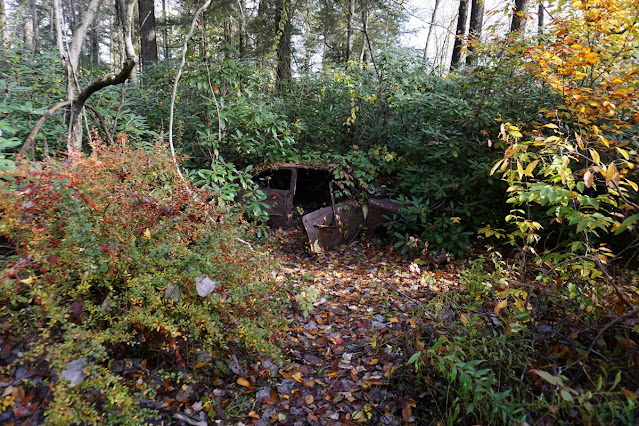
Car Ruins on the Cedar Swamp Trail


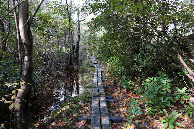
Cedar Swamp Boardwalk

Rare Mountain Cedars


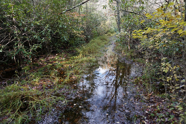
Flooded Out Double Pond Trail
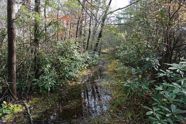
Double Pond Trail

Wednesday, October 27, 2021

Ramapo Reservation Waterfalls

Ramapo County Reservation
Bergen Co.,
New Jersey

Hiking Trails:
Vista Loop Trail: Yellow blaze
Ridge Loop Trail: Blue blaze

Total Time: 0:55
Estimated Distance: 1.8 miles

Pros: Scenic lakes, nice foliage, and waterfall
Cons: Area is very busy
Hike Type: Lollipop Loop
Level of Difficulty: Easy

Map of Route:
https://goo.gl/maps/4JGpfPtoAxb7DW2a6

My office is very close to Ramapo Reservation, and this was a beautiful fall day with a large volume of rain earlier in the week. There was an early season Nor'easter that dumped 4 inches of rain in the area, and figured it would be worthwhile to check out the waterfalls.

I parked in the main parking area, and took the Vista Loop Trail, crossing the bridge over the swelled Ramapo River, and then over to Scarlet Oak Pond. I then continued along the trail to the waterfalls, crossing the brook and ascending the short climb to the bottom of the falls. The falls were very impressive, and flowing very strongly. I continued on the Vista Loop Trail, to the Ridge Loop Trail, going back down the back to the Vista Loop Trail which I took back to the beginning of the hike.

Map of the Route

Ramapo River Overflowing at the Bridge


Overflowing Scarlet Oak Reservoir


Scarlet Oak Reservoir


Vista Loop Trail Fall Foliage


Ascent to the Waterfalls


Sunday, October 24, 2021

Bearfort Ridge West Ridge and West Loop

Abraham Hewitt State Forest
West Milford
Passaic Co.,
New Jersey

Hiking Trails:
Bearfort Ridge Connector Trail: Blue-green blaze
Bearfort Ridge Loop Trail: Green blaze
West Ridge Trail: Pink blaze
Ernest Walter Trail: Yellow blaze

Total Time: 3:15 hour
Estimated Distance: 5.3 Miles

Pros: Good climb, multiple views, rock formations, and scenic lake
Cons: Non
Hike Type: Lollipop Loop
Level of Difficulty: Difficult

Hiking Partners:
Yehudah Koblick
Shimmy Rosenberg

Google Maps of Parking:
https://goo.gl/maps/tJwT7L2p84vKAiaX6

I had been in the area the previous Sunday, and it was amazing scenery with the fall foliage. I decided to come back and explore the new West Ridge Trail which goes along the western ridge of Bearfort Mountain in Abraham Hewitt State Forest along rocky outcrops and views.

We parked on Warwick Turnpike and took the Bearfort Ridge Connector Trail from the road, crossing over the bridge over Green Brook and then through a rhododendron forest. We then took the took the Bearfort Ridge Loop Trail trail up the mountain, passing rock outcrops and a nice view, and then took the West Ridge Trail down and across the rocky ridge to the trail end at the Ernest Walter Trail. We took the Ernest Walter Trail to the spur trail that overlooks West Pond, with beautiful scenery and foliage, and then continued to the Bearfort Ridge Loop Trail. 

We took the trail along some ups and downs and views, and then took the trail back down the mountain and back to the Bearfort Ridge Connector Trail back to our car.

Map of the Route

Signs at the Trailhead

Bridge Over Green Brook

Small Waterfall Over Green Brook

Shimmy at a Rocky Outcrop on Bearfort Ridge

View on Bearfort Ridge

Yehudah at Bearfort Ridge


Manhattan Skyline in the Distance


Views from West Ridge


Yehudah and Shimmy on West Ridge


West Ridge Trail Terminus

Foliage on the Earnest Walter Trail

Ernest Walter Rock Scramble near West Pond

Ascending the Ernest Walter Rock Scramble near West Pond

West Pond

Foliage View from West Pond


View at the Ernest Walter / Bearfort Ridge Trail Intersections


Swamp with Rocky Outcrop Along the Bearfort Ridge Loop


Rhododendron Trail at the End of the Hike


Green Brook and Bridge Near the End of the Hike