Sunday, August 29, 2021

Breakneck Bypass and New Nimham Trail

Hudson Highlands State Park,
Dutchess / Putnam Counties,
New York

Hiking Trails:
Wilkinson Trail: Yellow blaze
Breakneck Bypass Trail: Red blaze
Breakneck Ridge Trail: White blaze
Nimham Trail: Green blaze

Total Time: 3:25 hour
Estimated Distance: 2.25 Miles 

Pros: Good climb and great views
Cons: Breakneck Trail very busy
Hike Type: Loop
Level of Difficulty: Very Difficult

Map of Route:
https://goo.gl/maps/8LPRGQmAvtu7azep9

I was at Breakneck Ridge earlier in summer, and noticed signs for a new trail in the area. The new trail starts at the flag area at the first stopping point at and first major view at Breakneck Ridge. I checked on this based on the new signs and saw this was a short loop from the view back down to the parking. Wanting to do a longer hike, I decided I'll do a longer hike and take this trail down on my return route.

I parked on Route 9D past the tunnel, at the Wilkinson Trailhead. I took this trail past the new Nimham Trail, and then took the Breakneck Bypass Trail at the split. This is a steep and continuous climb up Breakneck Ridge on the northern front, though it is not quite as steep and dramatic as the main Breakneck Ridge Trail. Near the top there is a great view facing Sugarloaf, where I took a short break, and then continued to the Breakneck Ridge intersection.

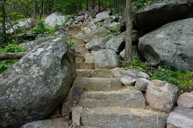
I took the Breakneck Ridge south, heading down many of the steep scrambles, and at the area with the flag at the Nimham Trail, I took this new trail, northward bound and down the mountain. This new trail is well-groomed and features nice stone stairs on its descent. At the Wilkinson Trail, I took the trail down and then back to my car.

Map of the Route

Trailhead on Route 9D

New Steps on the Wilkinson Trail

Explanative Plaque of the Routes at Breakneck

Sugarloaf Summit Closed Sign

Scramble up Breakneck Bypass

View Looking Towards Sugarloaf

Sugarloaf, the Hudson River, and Newburgh

The Same View Above, Further North

Breakneck and Breakneck Bypass Intersection

View to the Southeast from near the Breakneck Summit

Ascending to the Breakneck Summit

View from Breakneck Summit, Facing South

View of Storm King from the Breakneck Summit

Hudson River Gorge from the Breakneck Summit

View of Bull Hill from the Breakneck Summit

Breakneck Summit

Scramble Descending Breakneck

Hudson River and West Point in the Distance

Me at the Breakneck View

Pitch Pine on Breakneck

Storm King Across the River

Train at Storm King Across the Hudson

Zoomed into Storm King with a Train

Storm King and Cornwall

Hudson River and Pollopel Island

Flag at Breakneck Ridge Facing Storm King

View from Breakneck Facing South

Cliff Face at Breakneck

Looking South with Cold Spring and West Point in View

Nimham Trail Plaque at its Terminus

Pollopel Island from the Nimham Trail View

New Steps on the Nimham Trail

View of Newburgh Bay on the Hudson River from the Nimham Trail

Wednesday, August 25, 2021

Bear Mountain AT Evening Descent

Bear Mountain State Park,
Orange / Rockland Counties.,
New York

Hiking Trails:
Appalachian Trail: White blaze

Total Time: :30 hour
Estimated Distance: 1.6 Miles

Pros: Good descent with great views
Cons: None
Hike Type: One way
Level of Difficulty: Slightly difficult

Hiking Partners:
Joseph & Elisha Friedman

Map of Route:
https://goo.gl/maps/fk13NMY8RFu3LEu46

Bear Mountain has a weekly vintage car show every Wednesday evening in the summer, with car enthusiasts descending upon the large lawn and showing off their cool cars to all their friends and visitors. I enjoy going to this show in the summer, and traditionally have my wife drop my off at the top of the mountain while I run down and meet her at the show at the bottom. Last year, with the show cancelled during Coronavirus, I didn't have a chance to do this, so was glad to make this hike once again.

I started the hike at the top on Perkins Memorial Drive, near the tower, and took the Appalachian Trail down from the summit view. We took the trail all the way down from close to 1300, to the bottom at 160 feet. We passed the seasonal waterfall which was in full swing from all the rain, and then the view overlooking Peekskill. We then continued along the steep steps all the way down to the field where the car show was in full swing.

Map of the Route

View at Bear Mountain Summit

View at Bear Mountain Summit - West Mountain

View at Bear Mountain Summit - Dunderberg & The Timp

Me at the Bear Mountain Summit

Looking Towards Peekskill

Bear Mountain Summit Tower

View of Peekskill and the Hudson from the new Trail

Bear Mountain Waterfall on the AT

Ski Jump Overlook

Ski Jump Overlook and Iona Island

Me at the Ski Jump Overlook on the AT

Bear Mountain Bridge from the Ski Jump View

Anthony's Nose and the Car Show

Me at the Bear Mountain Car Show

Monday, August 16, 2021

North-South Lake Sunset Rock and Marys Glen

Catskill Forest Preserve,
Greene Co.,
New York

Hiking Trails:
North-South Lake Trail: Yellow blaze
Escarpment Connector Trail: Yellow blaze
Escarpment Trail: Blue blaze
Sunset Rock Trail: Yellow blaze
Mary's Glen Trail: Red blaze

Total Time: 2:45 hour
Estimated Distance: 3.6 Miles

Pros: Scenic lake, scenic hike, amazing views
Cons: None
Hike Type: Loop
Level of Difficulty: Slightly difficult

Hiking Partner:
Yehudah Koblick

Map of Route:
https://goo.gl/maps/dkLmBfCRLc5rm21V8

I used to go here often in my teens and lower 20's, but hadn't been back for a long time. I finally made a return trip after many years for Memorial Day, where I booked a campground and had intended to do some good hikes in the area. However, the weather was terrible, so I didn't camp out, but I did get to do one good hike in the afternoon in the area. I did this same hike back them, but the reversed direction, and I didn't stop at sunset rock. This time I made sure to stop at Sunset Rock as well, which affords a great view of the general North-South Lake area.

Yehudah and I camped together and shared a campsite. We were in Loop 1 of the Campground. We went from our campsite towards Mary's Glen, and walked along the North-South Lake Trail alongside the lake. We then took the Escarpment Connector Trail to the Escarpment Trail. We took the Escarpment Trail north, climbing up steadily to the first view at Artist's Rock. We then continued along the trail, and upon reaching the boulders below Sunset Rock, we scrambled up the side of the fallen boulders to the top of Sunset Rock, which afforded an amazing view of North-South Lake. We then took the short Sunset Rock Trail back to the Escarpment Trail, which we took to Newman's Ledge. Newman's Ledge offers a sweeping view of the Hudson Valley below as well as Round Top to the north. 

We continued the climb, reaching the Badman's cave, and then took the Mary's Glen Trail down. I could not believe the contrast between now when everything was all dry, and my trip in May when everything was all wet. Upon reaching Ashley Falls, it was just a trickle now, as opposed to a full waterfall on my previous trip. We continued along the Mary's Glen Trail to the road, and went through the campground back to our campsite.

Map of the Route

On the North-South Lake Trail

North Point from North Lake

Me and Yehuda at North Lake

North Lake

North Mountain Trail Connector Trailhead at the Campground

Artist's Rock

Artist's Rock

Artist's Rock

Me at Artist's Rock

North-South Lake from Sunset Rock

North-South Lake and Kaaterskill High Point in the Distance

Me at Sunset Rock

Me at Sunset Rock

Sunset Rock

Hudson River from Sunset Rock

Sunset Rock View

Sunset Rock Trail Intersection

Newman's Ledge

Newman's Ledge

Badman's Cave

Me at the Badman's Cave

Dried Waterfall at Mary's Glen

Dried Ashley's Falls at Mary's Glen