Sunday, January 30, 2011

Lake Welch

Harriman State Park
Rockland County,
New York


Total Time:
1:45 min
Estimated Distance: 2.3 Miles

Hiking Partners:
Yehuda Koblick
Shimmy Rosenberg

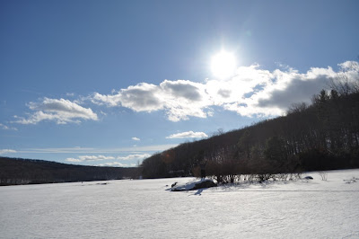
We had tried hiking along Lake Sebago but the rangers had not posted the lake as safe for walking upon, so we headed for Lake Welch which was fully frozen and posted as safe to walk on. The weather was cold and the snow was very deep. We started at the parking area off of County Route 106 after the causeway, an headed south towards the islands. Hiked through the islands, and then to the beach area. I never knew this before, but the beach area and parking lot is a major snowmobile area, and there were many snowmobilers there racing through the lot. From there went along the lake towards the dam of the lake to check it out, and then headed back along the lake towards the car.

Map of the route.
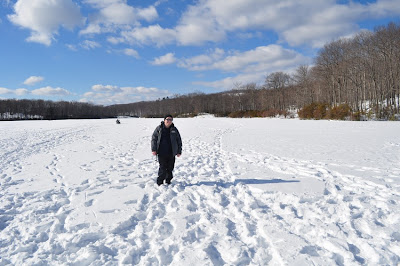
Yehuda and Shimmy at the beginning of the hike on the frozen lake.
An Ice Fisherman on the lake with his catch. Looks like Perch.
Me at the first island.
Me at Lake Welch beach.
Shimmy on the lifegaurd chair.
Shimmy at the flagpole at the far end of the lake.
Water flowing over the dam.
At the end of the hike. Facing Jackie Jones Tower.

Friday, January 21, 2011

Runyon Canyon

Runyon Canyon
Santa Monica Mountains
Los Angeles,
California


Total Time: 2:00 min
Estimated Distance: 3.5 Miles

Hiking Partner:

My wife Avigael

I had traveled to L.A. with my wife for a friend's wedding. We didn't really have enough time to go on a real hike, but while we were walking through Hollywood we realized the Santa Monica Mountains are very close nearby and found a park with trails and hiked there directly from Hollywood. The park contains heavily traversed trails with hikers and joggers, and goes through and around a canyon called Runyon Canyon. Though busy, it is an amazing contrast from the hustle and bustle of Hollywood Boulevard where we came from just below the mountain.

Being that we started this hike walking through Hollywood as a leisure walk, I was wearing sandals, and this was my first hike every wearing sandals (not recommended). I had seen the mountain from Hollywood and thr trails above, and from Hollywood Blvd traversed our way towards the park, climbing through the canyon and then up the trail that goes up the mountain to the east. The weather was perfect and I have never seen the city of L.A. so clear. It is usually full of smog with limited visibility; on this hike it was extremely clear and you could see for miles! Continued along past the view then back down the wide road path on the western flank of the the mountain and then headed back.

Map of the route.

Beavertail Cactus Grove at the entrance to the canyon
Atop the first viewpoint overlooking Hollywood.
Multi-million dollar homes in the Santa Monica Mountains
The view from the lookout.
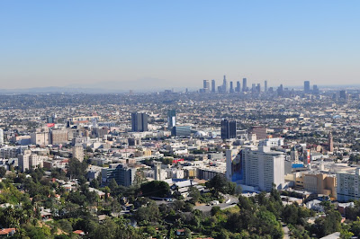
Hollywood in the foreground and skyscrapers of downtown
in the background.

View of Runyon Canyon. Looking south from where we started.
Me at the summit view. Notice the San Gabriel Mountains
in the background with snow.
View of the mountain from the side of the canyon.
The mountain we had climbed from the other side of the canyon.

Sunday, January 16, 2011

Lake Skanatati & Lake Askoti

Harriman State Park
Orange County,
New York


Trails:

Long Path: Green blaze
Dunning Trail: Yellow blaze
Arden-Surebridge (A-SB) Trail: Red blaze
Red Cross Trail: Red blaze

Total Time:
2:30 min
Estimated Distance: 3.7 Miles

Hiking Partner:

Sruli Rosenberg

This was our first frozen lake hike of the season. The last time I went with Sruli was last winter in the snow. We parked at the parking area on Lake Skanatati off 7 Lakes Drive and were delighted to see all the ice fisherman and sleds on the lake. We hiked on top of the frozen lake across its width to its inlet stream, and from there bushwacked to the Long Path, which we took all the way to the Dunning Trail.

From the Dunning Trail, I decided to try to hike on top of the frozen Pine Swamp, which is one of the largest in Harriman. The first part going over the swamp was fine, but then we would continuously fall in to tremendously large holes over the swamp to point where we had to turn back to the shore. From there we decided to explore the big hole of the Pine Swamp Mine, which looks very impressive in the winter with its large dangling icicles over its big hole. This is one of the best exploration mines in Harriman.

From there continued on the A-SB Trail back towards the summit view of Pine Swamp Mountain, and then took a break at the view snapping a bunch of pictures. From there went back on the Red Cross Trail north down the mountain to the road. We crossed the street and then headed into Lake Askoti and hiked on top of the frozen lake while going across the lake's small islands. From there we headed back to the parking area.

Map of the route.
I've been waiting for a long time to make the route
path go right in the middle of the lake!
Finally!
Sign at the entrance of the lake.

The crowds on the frozen lake.
Sruli Rosenberg on the left.
Me on frozen Lake Skanatati
Me on the rock peninsula in middle of the lake.


Lake Skanatati from the other end looking towards the parking area.
Me on top of the frozen Pine Swamp.
The Pine Swamp Mine taken from the swamp.
This is a perspective of the mine you will never see elsewhere!
Sruli at the entrance to the Pine Swamp Mine
Overexposed photo of the tunnel inside the mine.
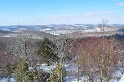
Lake Skanatati and Lake Kanawauke from atop Pine Swamp Mnt.
Zoomed out.
Ditto. Our footsteps are the ones going right through
the middle of the lake.
Walking along Lake Askoti

Me on the island at Lake Askoti

Sunday, January 9, 2011

Black Rock Mountain

Harriman State Park
Orange County,
New York


Trails:
Ramapo-Dunderberg (R-D) Trail: Red blaze
Dunning Trail: Yellow blaze
Hogencamp Road (unmarked)

Total Time: 2:30 min
Estimated Distance: 3.2 Miles

Hiking Partners:
Yehuda Koblick
Sruli Rosenberg

Black Rock Mountain is one of my favorite areas in Harriman. The terrain is much different than the rest of the area with the sparse shrubbery and large rocks on the upper areas. This area is especially beautiful in the snow. We had just gotten a fresh new snowfall of several inches a day earlier, and we were the first to make the snow trail up the mountain. The parking area had not yet been plowed so I backed up the car and jammed it in the side snowbank off the road, which is a mistake I would later regret. This was a bone-chilling day with a brutal wind, especially on the upper exposed summits where the wind blew strong and made the fresh snow whip up and fly around.

We started on the trailhead on County Route 106 right after the Little Long Pond. We went up the R-D Trail to the Black Rock viewpoint, took some excellent pictures, and continued along the R-D Trail all the way to the shelter by the bald rocks. At the shelter we met a large group of Japanese having a cookout. We continued from there on the Dunning Trail, heading east, and at the viewpoint facing south towards the Little Long Pond we decided to bushwack instead of going around the trail. This was a big mistake since the bottom part of the viewpoint is a steep ledge which is very difficult to navigate, and I had slipped on my way going down on a patch of ice under the snow and started rolling down out of control. Thank God I only injured my knee and nothing more. Was very dazed after the fall but was able continue ahead. Went ahead from that point onto the old Hogencamp Road Trail back to Route 210, and then walked along the side of the road at that point back to the car. Because the car was entirely wedged into the deep snow, it was totally stuck in there despite the 4 wheel drive. We all tried digging out and shaking the car and finally succeeded after half-hour in extracting the car.

Map of the Route


Summit of Black Rock Mountain.
Facing southwest.
Summit of Black Rock Mountain.
Facing West.
Me and Yehuda at the Black Rock summit.
Facing east.
Me and Yehuda at the Black Rock summit.
Facing south.
Me at the summit of Black Rock.
Facing south with Tom Jones Mnt in the background.
Sruli "warming up" at Black Rock summit.
Continuing Along the Ramapo-Dunderberg Trail.
Facing West.
Yehuda and Sruli walking along the R-D Trail.
Japanese Cookout in the Shelter!
Viewpoint off the Dunning Trail.
Facing south towards the Frozen Little Long Pond.

Sunday, January 2, 2011

Doodletown Ghost Town

Bear Mountain State Park
Rockland County,
New York


Trails:

Cornell Mine Trail: Blue blaze
1777 E Trail: Red blaze
Doodletown Road (unmarked)
Suffern-Bear Mountain Trail: Yellow Blaze
Doodletown Bridle Path (unmarked)

Total Time: 1:45 min
Estimated Distance: 3.3 Miles

The temperature was above freezing and the snow had been melting. It had rained in the morning and the melting snow had given a strong fog which made visibility very poor. I figured this was a good circumstance to visit the famous ghost town of Doodletown. I had not been to Doodletown in over 3 years, so this seemed like the perfect day. Plenty of wet snow around, and an eerie fog to complement this ghost town of abandoned foundations.

I parked the car on Route 9W right near the entrance to Iona Island. Took the Cornell Mine Trail along the side of the brook, past the waterfall which the locals used to call "The 10 Footer", and then veered off towards the 1777E Trail and Doodletown Road. Continued along Doodletown Road walking past the abandoned foundations and their placards, and then went off to the Suffern Bear Mountain Trail and then along the Doodletown Bride Path heading back. Went through some more Doodletown Historical Sites, and zigzagged back to Doodletown road and back to Route 9W.

Map of the Route

Dam along the brook on the Cornell Trail
Cornell Trail in the snow and fog.
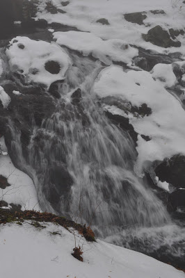
The "10 Footer" Waterfall.
Hard to capture the prettiness with the monotone colors.
The main fall of the "10 footer"
Foundation in Doodletown with placard.
Doodletown Reservoir
Another view of the Doodletown Reservoir
The Montville Schoolhouse site.
This was one of the last structures of Doodletown to be demolished.
Sign explaining the Doodletown historical sites
by Doodletown Road and the Suffern-Bear Mnt Trail