Harriman State Park
Orange Co.
New York
Hiking Trails:
White Bar Trail: White blaze
Ramapo Dunderberg Trail: Red blaze
Victory Trail: Blue blaze
Total Time: 2:00 hour
Estimated Distance: 3.1 Miles
Pros: Quiet area, nice views, and good scramble
Cons: None
Hike Type: 2 Car Point to Point
Level of Difficulty: Difficult
Google Maps of Parking:
Car 1: https://maps.app.goo.gl/m41xHCJ963MFkjjG9
Car 2: https://maps.app.goo.gl/qYDKn9S2qitkEUbm8
Hiking Partner:
Yehudah Koblick
We parked the first car at the White Bar Trailhead on Kanawauke Road, to the Carr Pond Mountain view. We then climbed down the valley into the Parker Cabin Hollow, and then back up to the Triangle Trail intersection. We then took the Ramapo Dunderberg Trail up the scramble to the great view on Parker Cabin Mountain. We then took the trail back down the mountain to the Victory Trail back to the trailhead where our other card was parked.
 |
| Map of the Route |
 |
| Trail Map at the Beginning of the Hike |
 |
| Trees on Carr Pond Mountain |
 |
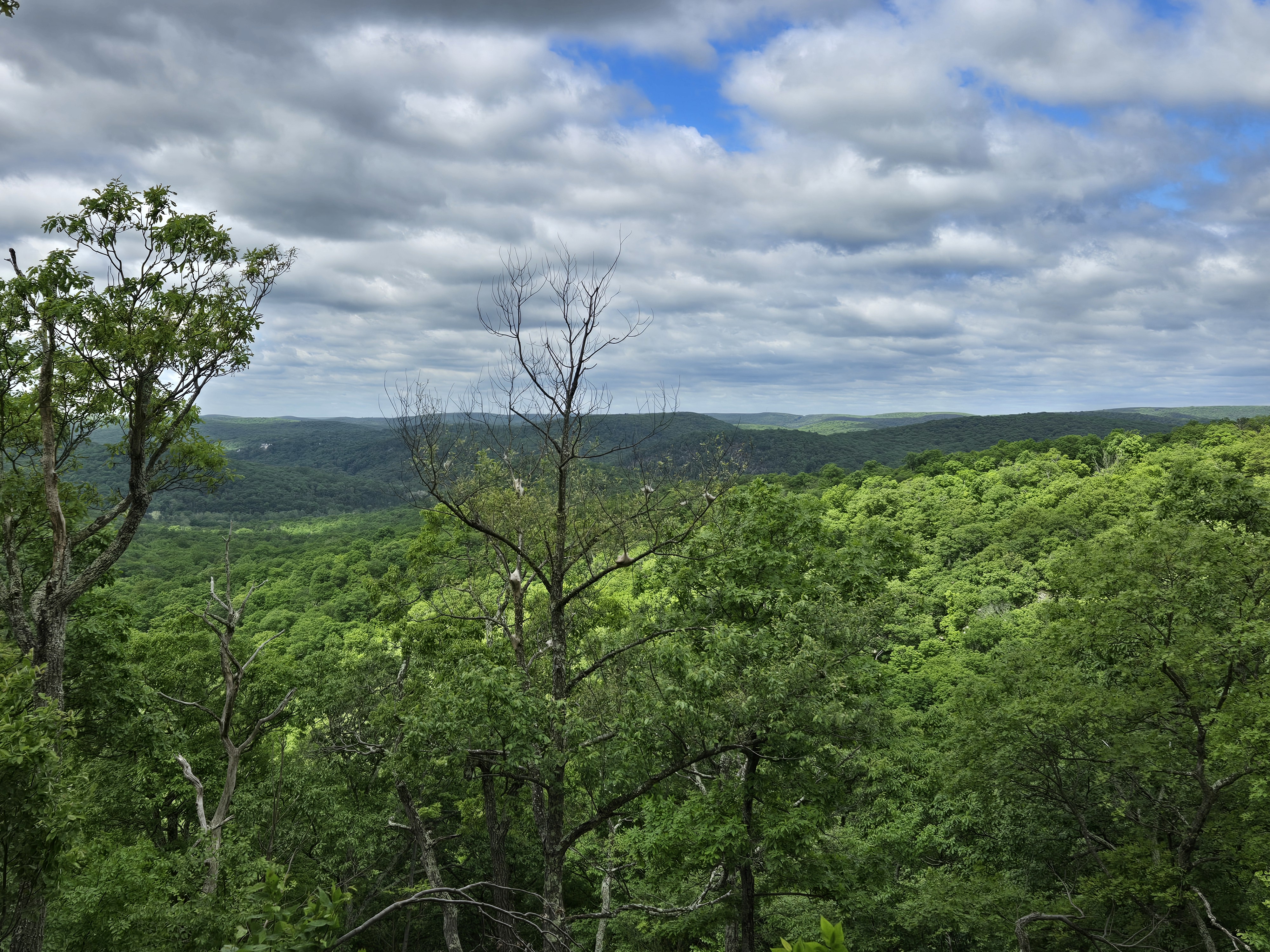
| Carr Pond Mountain View |
 |
| White Bar Trail |
 |
| Funny Rock White Bar Trail |
 |
| Ascending Parker Cabin Mountain at the Scramble |
 |
| Yehudah at Parker Cabin Mountain Above the Scramble |
 |
| Parker Cabin Mountain Rock |
 |
| Parker Cabin Mountain Northern View, Towards Lake Sebago |
 |
| Parker Cabin Mountain |