Putnam and Dutchess Counties,
New York
Total Time: 3:20 hr
Estimated Distance: 4.5 miles
Level of Difficulty: Very Difficult (Serious Rock Scrambling almost the whole way up 1200 feet)
Level of Interest: Highly Recommended; one of the best hikes.
Points Of Interest: Outstanding scramble up the mountain, fabulous views
Trails:
Breakneck Ridge Trail: White blaze
Wilkinson Trail: Yellow blaze
Hiking Partner:
Sruly Rosenberg
Breakneck Ridge is one of my most favorite hikes in the region. It is perhaps the most challenging and rewarding of all the hikes in the Hudson Highlands region. Its an intense and challenging hike, and requires scrambling on hands on feet almost all the way up. One of the only disadvantages is that due to its popularity is always very busy and full of hikers, especially on weekends. My usual route is up the ridge and then down through the notch and the Corning Estate, but I decided to do a different route this time but way of Sugarloaf Mountain, which is a hike I have never done before.
We parked on Route 9D right after the Breakneck mountain tunnel where the road goes under the mountain. We hiked up Breakneck and took in all the climbs, scrambles, and views, and continued along past the summit. Our goal was to make it to Sunset Point and then head down the Wilkinson, but the hour was getting late so we cut across north along the unmarked path that is shown on path going along the Cascade Brook. The path is shown on the Trail Conference Maps but you may have to bushwack a little to find it. We took that path until the Wilkinson Trail, which then started climbing to the summit of Sugarloaf. Sugarloaf has an outstanding view on its summit, though it is not quite as tall as Breakneck which is visible directly south or Storm King directly across the river. From the summit we continued down to the bottom of the mountain and then down to the road where we had to walk just a little to get to our car.
Google Map of Parking:
View Hiking Blog Localities in a larger map
 |
| Map of the Route. |
 |
| At the first part of the scramble. |
 |
| At the first view on Breakneck. Facing south with Crow's Nest on the right, The Hudson River, Route 9D, and Bull Hill. |
 |
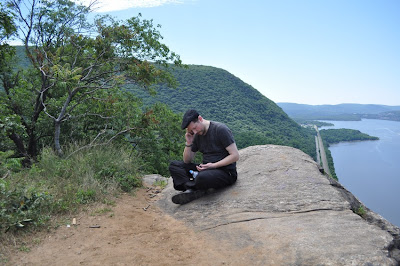
| Sruly Atop the first Breakneck View |
 |
| Me at the First Viewpoint with the Flag |
 | |
| Kayaking Group Below in the Hudson. Taken From the First View. |
 |
| Continuing the Ascent |
 |
| Storm King Mountain on the other side of the Hudson River |
 |
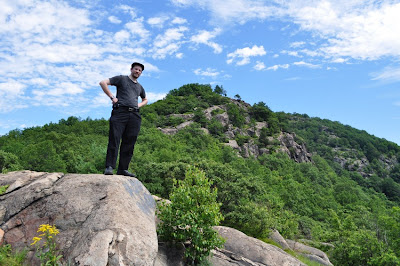
| Sruly Near the Summit. |
 | |
| View Atop Sugarloaf. Facing North, Toward the Newburgh-Beacon Bridge |
 |
| Another View from Sugarloaf. Facing northwest. |
 | |
| Me with Dead Tree atop Sugarloaf. Behind the Hudson River is the edge of Breakneck, with Schunnemunk in the background. |
No comments:
Post a Comment