Sunday, March 27, 2011

Sterling Hill Mine

Ogdensburg
Sussex County,
New Jersey

Although this excursion was not a hike, it is still noteworthy for the blog due to the good workout and interesting terrain. On the last Sunday of every month, the Sterling Hill Mine is open to collectors who can go in the mine dump and into the Passaic Pit quarrying area to dig and move rocks. This was the first Sunday since the winter that it was opened, so I came to take part in the diggings, taking a few photos of the quarry in the process. More information on minerals can be found at the author's website at www.minerals.net.

Below are various photos in the Passaic Pit:


Monday, March 21, 2011

Pine Meadow Brook in Snow

Harriman State Park
Rockland County,
New York


Trails:
Pine Meadow Trail: Red Blaze
Stony Brook Trail: Orange Blaze
Kakiat Trail: White Blaze
Hillburn Torne Sebago (HTS) Trail: Orange Blaze

Total Time: 1:30 hr
Estimated Distance: 2.5 Miles

This was the last real snow of the season, and I had to take advantage despite it being a weekday and hence a workday. It was only about an inch or two of snow (about three inches at the highest point of the hike), but it was a very pretty heavy, wet snow. This is one of my favorite hikes, and is also the most popular trail in the entire Harriman State Park. I normally do this route after the first snow of the season, but this time it was the last snow of the season.

I parked at the Reeves Meadow Visitor Center off 7 Lakes Drive near Sloatsburg. Hiked the Pine Meadow Trail along the brook which was roaring to the Stony Brook Trail, and then along the Kakiat Trail past the Cascade of Slid waterfall. Took the HTS Trail for a short duration across the brook, then took the Pine Meadow Trail back towards the return and back to my car.

Map of the Route.
Pine Meadow Trail in the snow.
Hiking Along the Stony Brook

Intersection of Pine Meadow and Stony Brook Trails
Cascade of Slid
Pine Meadow Brook from the HTS Bridge

Sunday, March 13, 2011

Haverstraw Palisades

Hook Mountain State Park
Rockland County,
New York


Trails:

Bike Path: Unblazed
Connector Trail: White blaze
Long Path: Green blaze

Total Time:
1:45 hr
Estimated Distance: 2.6 Miles

I parked in Haverstraw behind the enormous mine works at the terminus of the biking trail that goes along the Palisades Cliffs and the Hudson River. Walked down the bike path until the abandoned park cabin, where I picked up the white-blazed Connector Trail that goes to the Long Path. This trail passes near a trail tunnel where the railroad goes underneath the mountain, so it was interesting watching a trail go through the tunnel while hiking.

Once I hit the Long Path I continued to the summit. Although the summit is a narrow ridge above both sides which are lower, there are surprisingly no good view available. At this point I turned back, went down the Connector Trail, and went south once I hit the bike path to explore the old quarries along the side of the mountain. These quarries are very old and were used to mine traprock at the turn of the century. Their walls are very impressive sheer cliffs with vast amounts of talus at their foot. The Palisades Park was created to protect the area from being totally obliterated from the quarrying operations. From there turned around and went along the bike path back to the car.

Map of the Route.
Abandoned Ranger Cabin
Inside the Abandoned Ranger Cabin
The Start of the White Connector Trail
View of the Quarry Wall while ascending the white Connector Trail
Mountain Behind the Quarry.
Ascending on the white Connector Trail./
Lake DeForest from the top. Facing Southwest.
The Hudson River at Haverstraw Bay from the the top.
Facing Northeast.
The bottom of the Quarry.
A little snow still remains.
Looking up the Quarry Cliffs and the Talus.
Benedict Arnold Treason Site along the Bike Path.
Ship in Haverstraw Bay. From the Bike Path.

Monday, March 7, 2011

Kakiat Park under flood

Rockland County,
New York

Trails:

Old Mill Trail: Blue blaze
Kakiat Trail: White blaze
Mountain Trail: Orange blaze

Total Time: 1:00 hr
Estimated Distance: 1.75 Miles

There had been an enormous rainstorm on Sunday with about 5 inches rain within a 24 hour period. The day after this storm there was flooding all over the area, so I figured this would be a good day to hike at Kakiat which is prone to flooding to observe this. Since it was a weekday (I had not been able to hike on Sunday because of the rain), I had to keep this hike short.

Started at the Kakiat parking area, crossed the bridge at the raging Mahwah River, and took the partially flooded-out Old Mill Trail for its length until the Kakiat Trail. I had to hike on rocks and detours to avoid the flooded and washed out portions. Took the Kakiat Trail slightly up the mountain, and veered off to the Kakiat waterfalls, which were falling strong. From there I bushwacked up along the side of the mountain to the lower Kakiat viewpoint, and then hiked down the Mountain Trail back to the parking area.

These pictures were taken with my cell phone camera since I didn't have my regular camera with me.

Map of the route.
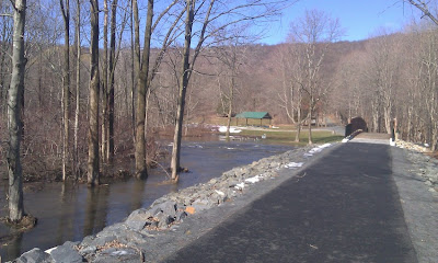
Entrance and bridge with overflowing Mahwah River.
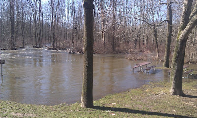
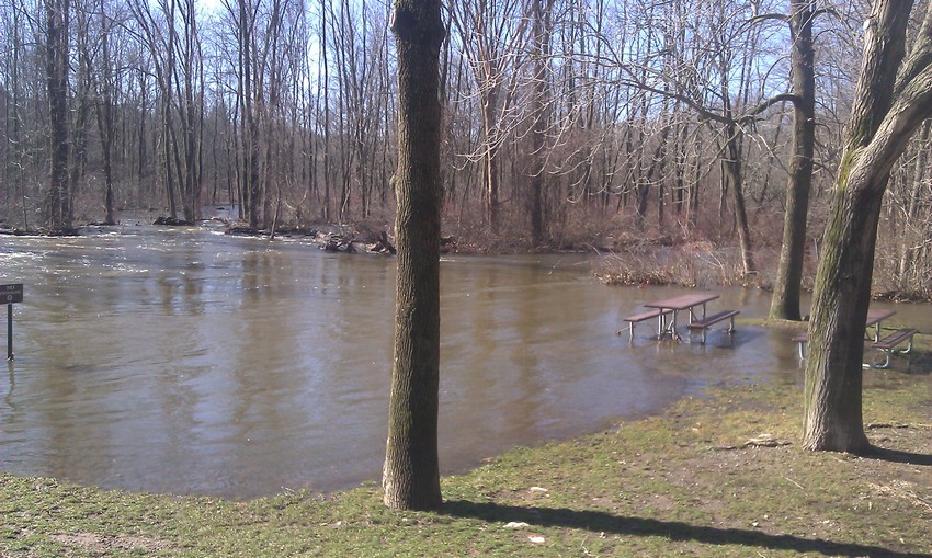
The flooded picnic area.
Not a good day to have a picnic.
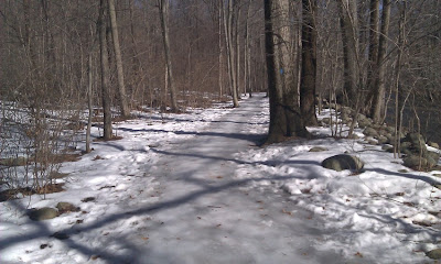
Still a little bit of snow left on the Blue Mill Trail.
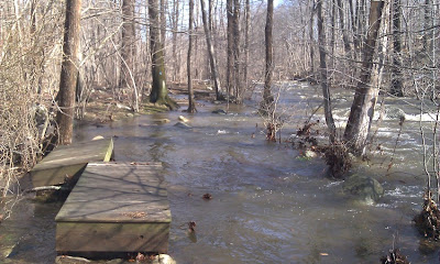
Walking along the Old Mill Trail.
I have never seen the river overflow this much.
Notice how the force of the water pushed aside the small bridges.
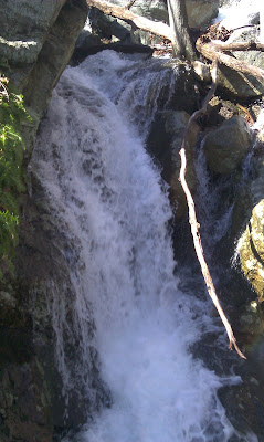
The Kakiat waterfall.
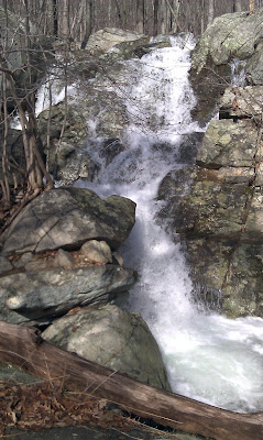
The uppermost Kakiat waterfall.
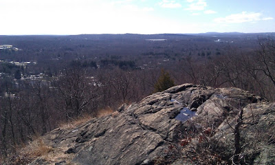
View from the lower Kakiat viewpoint off the Mountain Trail
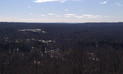
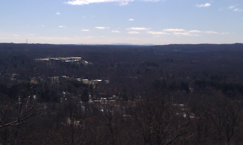
Manhattan Skyline visible in the distance from the lower Kakiat viewpoint.