Showing posts with label Cobus Mountain. Show all posts

Sunday, December 25, 2022

Cobus Mountain Winter Hike

Cobus Mountain Winter Hike
Kakiat County Park /
Harriman State Park
Rockland Co.,
New York

Hiking Trails:
Old Mill Trail: Blue Blaze
Kakiat Trail: White Blaze

Total Time: 0:25 hour
Estimated Distance: 2.5 Miles

Pros: Good climb and excellent view
Cons: None
Hike Type: Reverse Lollipop
Level of Difficulty: Difficult

Google Maps of Parking:
https://goo.gl/maps/NkxXbLfHSQyV3yc3A

The weather was exceptionally cold, with a low in the single digits overnight and very gusty winds. We wrapped up well, and headed up Cobus. We parked in the main Kakiat area, took the Old Mill Trail around the loop, and then veered onto the Kakiat Trail. We bushwhacked by the Kakiat Waterfalls, which is flowing stong and had been frozen around the edges. We then continued back to the Kakiat Trail, and took it for a short distance the intersection with the gas line. We then climbed up Cobus Mountain, then climbed back down, taking the Kakiat Trail to the Old Mill Trail to our car.

Map of the Route

Ice on the Frozen Overflow on the Mahwah River

Mahwah River

Mahwah River Icicles

Ice from Frozen Rain along the Old Mill Trail


Mahwah River and Ice


Kakiat Waterfalls and Icicles


Upper Falls at Kakiat


Ascending Cobus Mountain

Cobus Mountain View


Frozen Stream Below the Waterfalls

Sunday, December 13, 2020

Cobus Mountain in the Fog

Kakiat County Park /
Harriman State Park,
Rockland Co.,
New York

Hiking Trails:
Old Mill Trail: Blue blaze
Kakiat Trail: White blaze

Total Time: 1:20 hour
Estimated Distance: 2.4 Miles

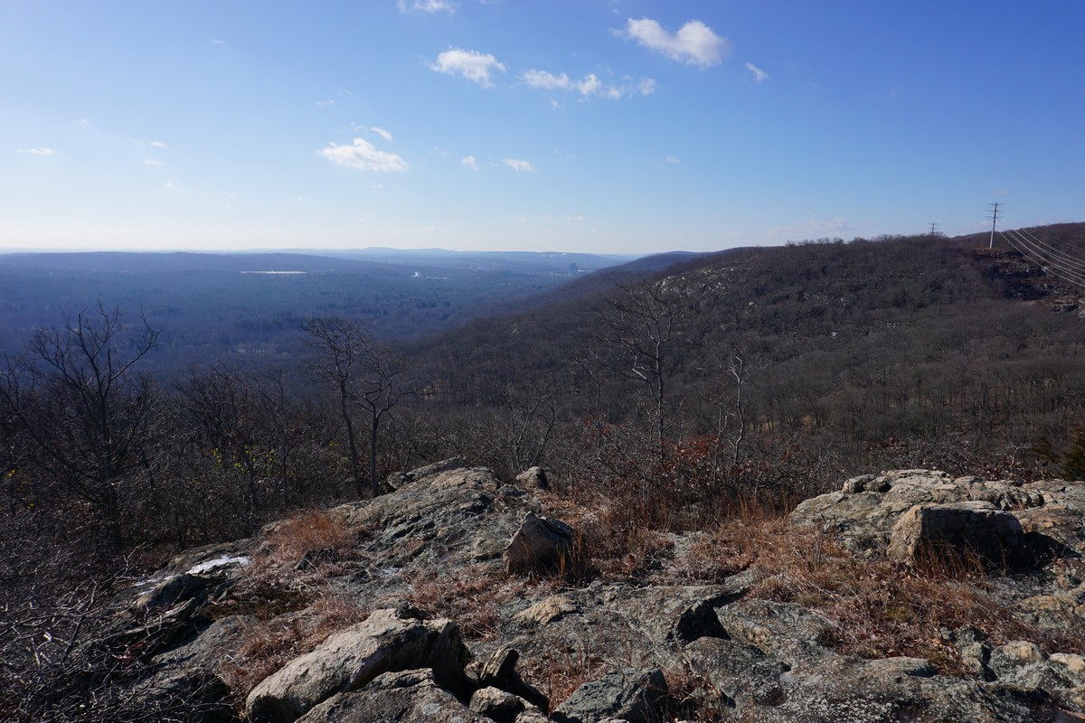
Pros: Scenic area with a great view
Cons: View marred by power lines
Hike Type: Eight loop hike
Level of Difficulty: Difficult (Bushwack and steep incline)

Google Maps of Parking:
https://goo.gl/maps/m9vUUiUpJaZ8a4pD6

This hike is short and sweet. It's close to where I live, and is a short but still with a good climb and great view. There is no direct trail to the top, so it's not a popular hike, and unknown except for expert hiker. It's across the valley from the much more popular Kakiat Mountain.

This hike was on a very warm December day. It was 60 degrees and I was wearing short sleeves. Not bad for December! The morning featured very dense fog, but when I climbed to the top of the mountain it was above the fog level on the ground and bright and sunny. By the time I climbed down, most of the fog had already burned up.

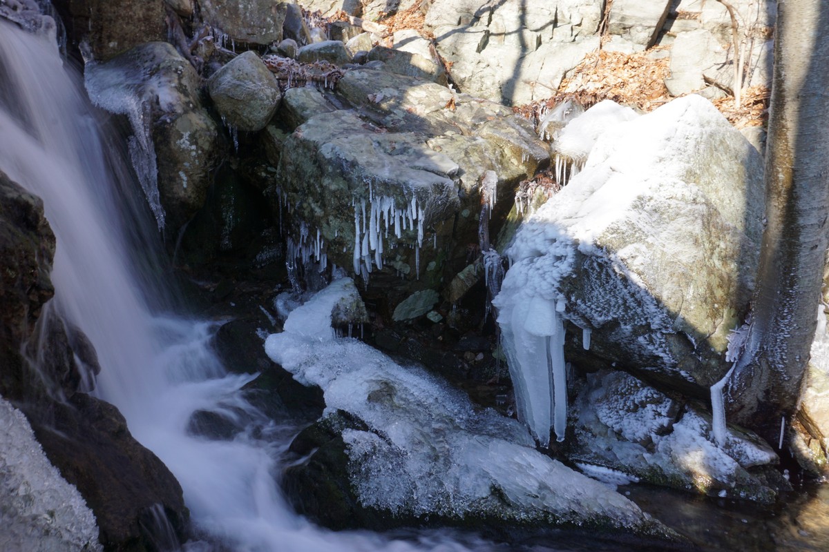
I parked at the Kakiat Park parking area, and crossed the Mahwah River, taking the Old Mill Trail to it's end at the Kakiat Trail. I then took the Kakiat Trail up the mountain, past the Gas Line, and at the trail bend, I bushwacked up the mountain to the view at the Lower Peak of Cobus Mountain. At the view, I went down along the ridge, bushwacking down to the Gas Line, and crossing the Gas Line to waterfalls. The waterfalls was in full force from the recent rains. I then crossed the brook back to the Kakiat Trail, climbing down the trail and then cutting across a shortcut back again to the Kakiat Trail, which I took to the terminus and then crossed the bridge back to my car.

Map of the Route

Mahwah River in the Fog

Bridge Across Kakiat at the Entrance of the Park

Another Foggy View of the Mahwah River

Gear at the Old Mill

Bridge Across the Kakiat Brook at the end of the Old Mill Trail

Foggy Moment along the Kakiat Trail

Another Foggy View at the Kakiat Trail

View Above the Foggy Clouds at the Cobus Mountain Ascent

View from Cobus Mountain, Facing South

Rocky Area at Cobus Mountain

View from Cobus Mountain, Facing Southeast

View of Kakiat Mountain from Cobus Mountain

Fog Lifting Below the Mountain

Me at Cobus Mountain

Another View on Cobus Mountain, With Fog Below

Rock Summit on Cobus

Kakiat Waterfalls

Sunday, December 6, 2015

Kakiat to Cobus Mountain

Kakiat to Cobus Mountain
Kakiat County Park and Harriman State Park
Rockland Co.,
New York

Hiking Trails:
Old Mill Trail: Blue blaze
Kakiat Trail: White blaze

Total Time: 1:30 Hours
Estimated Distance: 2.2 Miles
Level of Difficulty: Moderate
Level of Recommendation: Recommended

Points of Interest: Very good view
Cons: Power lines obstruct natural view

Hiking Partner:
Shimmy Rosenberg

We were short on time so had to do a relatively short and close hike. We parked at the Kakiat parking area, crossed the Mahwah River, and took the Old Mill Trail to the Kakiat Trail. We started the climb up the Kakiat Trail, and veered off by the gas line partially up the mountain. We bushwacked north up the ridge to the view at Cobus. This viewpoint has an excellent 270 degree field of view. We then turned around at this point, took a more easterly path down the mountain, and met up witht the gas line trail down the mountain. We went around the south side of the station to the other gas line, back to the Kakiat Trail, back to the Old Mill Trail, and back to the parking area.

Map of the Route
Harriman/Bear Mountain State Parks Southern Map

New Warning Sign at the Foot of the Mountain.
This Sign was put up After Several People have Gotten Lost in the Park

View While Ascending Cobus

View from Cobus Looking East

View from Cobus Looking Northeast

View Looking Southwest.
Looking at the Ramapo Escarpment.

View from Cobus Looking Southwest

View Looking Southwest Over the Kakiat Valley

Me at the Summit of Cobus Mountain