Harriman State Park
Orange Co.,
New YorkHiking Trails:
White Bar Trail: White blaze
Island Pond Road: Unblazed
Stahahe High Peak Trail: Unblazed
Nurian Trail: White blaze
Dunning Trail: Yellow blaze
Total Time: 1:55 hour
Estimated Distance: 3.9 Miles
Pros: Scenic lake and pretty area
Cons: Parking can fill up quickly
Hike Type: Reverse Lollipop Loop
Level of Difficulty: Difficult
Google Maps of Parking:
https://goo.gl/maps/NBN41jEjsZhVG6YK8
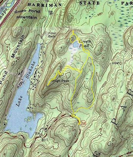
It had been a very long time since I was at Stahahe High Peak (almost 13 years!) It was a nice spring day, in fact somewhat cool with a strong breeze at the top of the mountain. I parked at the trailhead at the White Bar Trail on County Route 106, and took the White Bar Trail for a short distance to Island Pond Road.
I then was on the lookout for the trail intersection with the Stahahe High Peak Trail, which is unblazed. I found it at the cairn, and took it up the top. The path is unofficial and isn't as well marked but it can be easily followed to the view. I then turned around back to the intersection of the Island Pond Road, taking it to the Nurian Trail for a short period and then to the Dunning Trail.
The trail crisscross with the White Bar Trail and intersects it twice. At the second intersection, where the Dunning Trail ends, I took the Dunning Trail alongside Green Pond. This is a highly scenic part of the park, where the trail scrambles and goes underneath a rock overhang. I then took the Dunning Trail back to the White Bar Trail and then back to my car.
![](https://blogger.googleusercontent.com/img/b/R29vZ2xl/AVvXsEiXqG0-JTxENsyhHgb3wExQWJXisWh88HTBL8nq2uR4UJoKl9y42aubCCazpNvme9ZfpPkX3TY-U4WFWuTnmCeQKhGheH9DOtHroxWlKe9kFlHEbFSNIg-iEW-clJspCCIDt-4FDgERj6PgIuNeqAQC6Tii72gAPkebEzVs0GmTofsNy4iSDoblkzqg/w542-h640/2023-05-21%20Stahahe%20High%20Peak%20and%20Green%20Pond.jpg) |
Map of the Route |
![](https://blogger.googleusercontent.com/img/b/R29vZ2xl/AVvXsEgshdivy86HizWOjoC_oLq-7jBFdP_ze2vRC3YU3dhcIvYw00zGcUoCjA3e8-oZpMfghJ4ZXwpr4zBPxciNLgJYX6_bGYi5fhxuJD9YVsAwrVGIDUbVdcbvNw8iOkjRDTkAulmBWA1tzN6KvkgaEYaEW0aMVgul8oNkSzY4SOxOubXR2v11qpLGo4iV/w640-h426/stahahe-high-peak-green-swamp-harriman-hike-01.jpg) |
Island Pond Road |
![](https://blogger.googleusercontent.com/img/b/R29vZ2xl/AVvXsEjr39d8xoQwJeFrbjP9pjw8cTbHV4RAFts_4_9M4BXdHM8IFpLQU4ZEgmLQ1QK8WVoZOvawx6QT0tYb_Ee1j0fyRc09re9Ignh1kC_k_HbY_ZBdIcBy96G13PZ-XTYmxAecicycMLeEJV3pTLdrPIyUzd60qwM-MWv7PCFy2eKMrl1e-wa1x7a9bDyA/w640-h426/stahahe-high-peak-green-swamp-harriman-hike-02.jpg) |
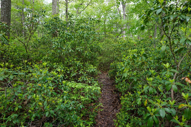
Path to Stahahe High Peak through the Mountain Laurel |
![](https://blogger.googleusercontent.com/img/b/R29vZ2xl/AVvXsEgg1EIXBekqkkArR-HwbDtrHG4D-t4ksO91E-3UeOYCv_vk-6pdC_f8j5agJyL-yJFvKvh-jiLHW_N34V2rZ5MHT10jEZ7FntEexG5livcAiuI1NAn_us5qjQy-a-cljGqi8IRlXRWxaE1mpsLt6WtgeYMUWl9fem6waLSPvuU9irSnit5N1xPEwX49/w640-h426/stahahe-high-peak-green-swamp-harriman-hike-03.jpg) |
Approaching Stahahe Peak |
![](https://blogger.googleusercontent.com/img/b/R29vZ2xl/AVvXsEixLtYLyt1ttcjnYMuS-3CW7V7_uURWoSeGcv9XxLcEaBvqRCVAvLe210rswIGzi1xrPBrAgbnNZm1pp131Zqm9ul6_RrmPWU069Jnenhgh14Ri9ToYpxZjAeOGBN5gBld9HlLb3C6kubySIjoj7W3y4GFB3Y-p4ipAjRrRIWI_bvJkr73SH3T_wDLs/w640-h426/stahahe-high-peak-green-swamp-harriman-hike-06.jpg) |
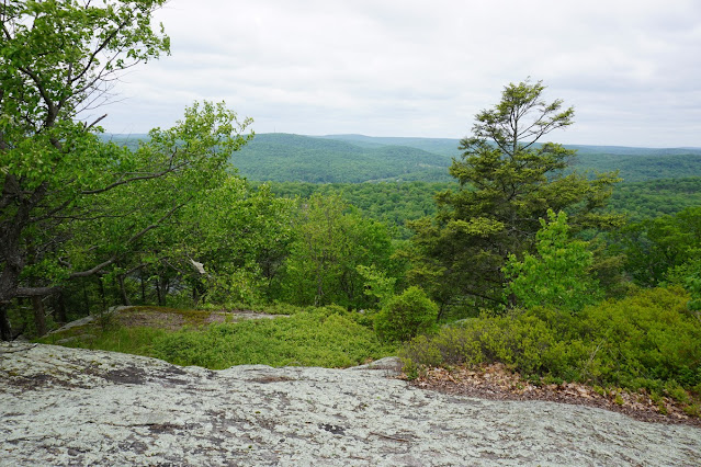
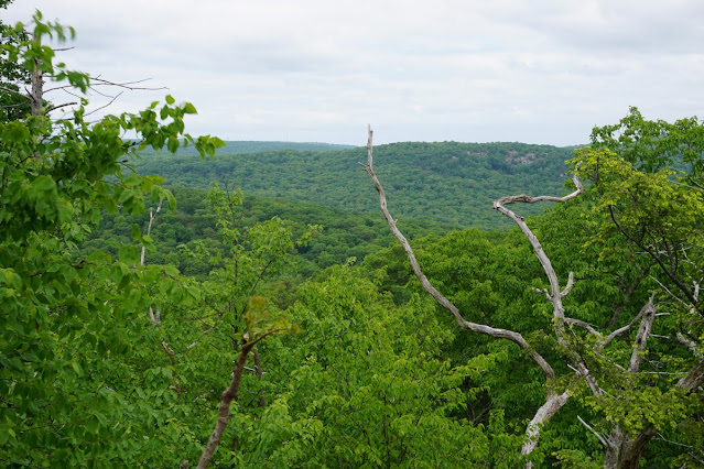
Stahahe High Peak View |
![](https://blogger.googleusercontent.com/img/b/R29vZ2xl/AVvXsEiXqnfZJOuggsaxI1lPSyjaYXjORjkN3XdrMdIz_MAgqylZSNvbfiTl8BnstOqKAFoUhOc9HaFoF_RpzfEEc9KcU-d-gn9RqP4YM4dDUNe9F2GwcXbuX3mV5EEBzhcMRWulLJukV2p67LDbcJCMsgiTzFQkmiZEk1UkxCjj8d3JXm7gzftrZhQjhNEc/w640-h426/stahahe-high-peak-green-swamp-harriman-hike-10.jpg) |
View Above Lake Stahahe |
![](https://blogger.googleusercontent.com/img/b/R29vZ2xl/AVvXsEhr6h2AiE4DOnX84zDM-N5XQGjUqhz8kTEdggUnQQ6niHgP4NNG_NSqGPi337ChFDV9Njw2Q0HLLIrkslid_ktJt-aq2NqhlsQIDuOc_4aSk-L-c-v_thHSsbHhW5tEXgMsWgJ8m9HY2O2tTUfPYfTqVMTpYq7Zto5YA02HmL3Vf1hUkrWvk_Q180vr/w480-h640/stahahe-high-peak-green-swamp-harriman-hike-13.jpg) |
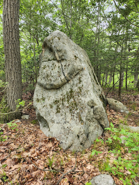
Large Rock on Island Pond Road |
![](https://blogger.googleusercontent.com/img/b/R29vZ2xl/AVvXsEgtEPQ7P9pHTgpPCPSbbG9U-8tsIpddNnnHVQyFzO1ijySd-YqIt6wWY6v_qBtXy5HIvfRy4BpHEz3__EYTMFdAFdb3yZZfJRpmfjd69GtZQoZcj9FyaLPNKdSW5tdxRH04UBfky5_OTFdXDx-NY3capU-jFLaVKSkq8mBgmbtbQhMjwKLnGZ0nUiTA/w640-h426/stahahe-high-peak-green-swamp-harriman-hike-14.jpg) |
View Past Green Pond |
![](https://blogger.googleusercontent.com/img/b/R29vZ2xl/AVvXsEh8ZKCDLsgoeyQKk1tXRHgL3tbyCDwXZrP0I4mUFmxtnDI16zsTmBIghKwlTJoxvK47Y7nMxcnXzuR5YK_suxLFUxADYompi_PMMOMLGbFSsPmStWhnafZQp8NWu7cd9c6MSWTCFXp-LhYtLA2viO2GoEA8fr-IKSmgoSVqh5-Et7jUSZlRZ5ixQ0bK/w640-h426/stahahe-high-peak-green-swamp-harriman-hike-17.jpg) |
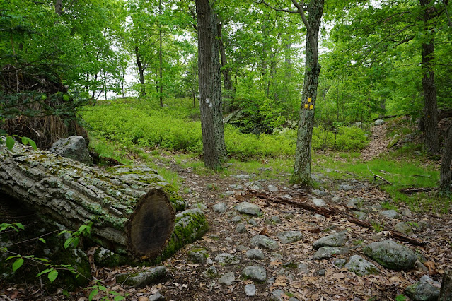
Nurian Trail & Dunning Trail Intersection |
![](https://blogger.googleusercontent.com/img/b/R29vZ2xl/AVvXsEgC61sk9_hgn-WablaN1uD1GfZqhPmKfn3RXb5zjTkPx3bf9gh_CmmvPo2EjaRmGCtS5d0lOa3MJIrTiGHzfdxTPPtmsT92HPJfqHfKL6gvg93lzIKQbFBrv06lkMeNkPTqWj4lOumDQv4wc-AJA6P3sxRnHHhfpgg5koQt8YNueMedCWQrj_pqd-5p/w640-h480/stahahe-high-peak-green-swamp-harriman-hike-18.jpg) |
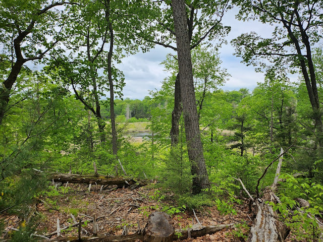
Approaching Green Pond |
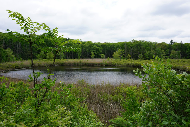
![](https://blogger.googleusercontent.com/img/b/R29vZ2xl/AVvXsEiNXY62aOd0zlKRTPTZ6ubUQa7fscpTUIHj7ugkEdmLhmr-xU2i43RqsfRecZ_8Rv80x1MfuT9oRLAEHFaWBd9_IhnIw0y5ptwiKypOIXdmhO8-Kes1ajye56p2uVTfVDfmHTmxa11viVOqIjrkTJN9xrcYESPlhJ0QQDoCo9UCPb_j2-3KshsgmT4n/w640-h426/stahahe-high-peak-green-swamp-harriman-hike-19.jpg) |
Green Pond |
![](https://blogger.googleusercontent.com/img/b/R29vZ2xl/AVvXsEjLaPWK3ZB75vl161FpLwXw2rdsKWvrd74Y-AZxrD7z_tuiitdxINuJqfc39hLNa5YYYI3MwNo5QGaey15Et41rpFnayjwbOuVmnZwzwsVHHjbE836V4vdkpOuhmLXE6xf86iD59kBlV9_E7jnMq6YOXKrmocSJ3IY97FNjiL5UP3eke0IDEsGSEBP6/w640-h426/stahahe-high-peak-green-swamp-harriman-hike-22.jpg) |
Overhand by Green Pond |
No comments:
Post a Comment