Windbeam Mountain Spring Hike
North Jersey District Water Supply Commission
Passaic Co.,
New Jersey
Hiking Trails:
Stonetown Circular Trail: Red blaze
Highlands Trail: Teal blaze
Windbeam Lane Extension: Unblazed
Total Time: 1:40 hour
Estimated Distance: 2.6 Miles
Pros: Good climb with great views
Cons: None
Hike Type: 2 Car Point to Point
Level of Difficulty: Difficult
Google Maps of Parking:
https://goo.gl/maps/csbuqam4fUgjeJR5A
Windbeam is a mountain that has a prominence from all sides and can be seen from miles away. It's a narrow, steep ridge that has excellent views from all sides. I had been meaning to hike this mountain for quite some time but haven't had the opportunity until now. The weather was finally beautiful after a week of rain and two previous weekend of heavy rain.
This was a two-car hike. We parked one car at the end of Windbeam Lane (there is a small spot at the end for just one car.) We parked the other car at the Stonetown Recreation Center, and started the hike from here. We took the Stonetown Circular Trail around the foot of the mountain, and then started the climb. The trail joined with the Highlands Trail as it climbed steeply up to the first view at Lower Windbeam Mountain. We continued climbing to the next view, with views on both sides of the mountain. And then we reached the summit with great views and a large flag on top.
We then took the climb down the mountain, which we took to the unblazed Windbeam Lane Extension Trail. We crossed around the fence blocking the trail, and our car was right there on the other side.
 |
Map of the Route
|
 |
| Skunk Cabbage on the Foot of Windbeam Mountain |
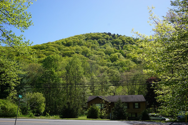 |
| Windbeam Mountain from the Startof the Hike |
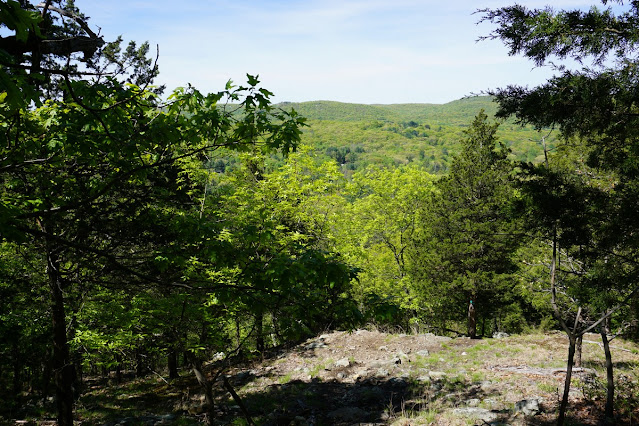 |
| First View, on Little Windbeam Mountain |
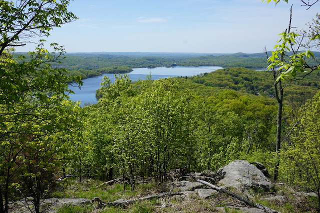 |
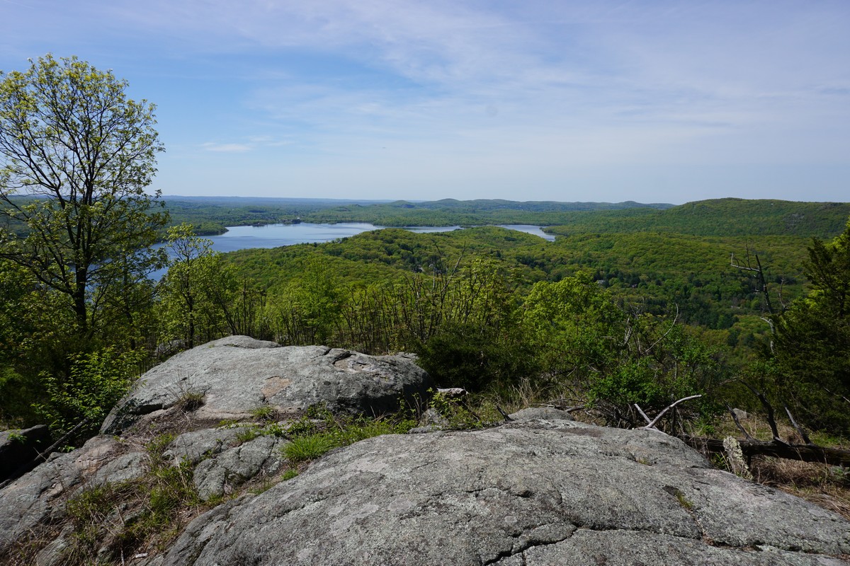
| View of Wanaque from Windbeam Mountain |
 |
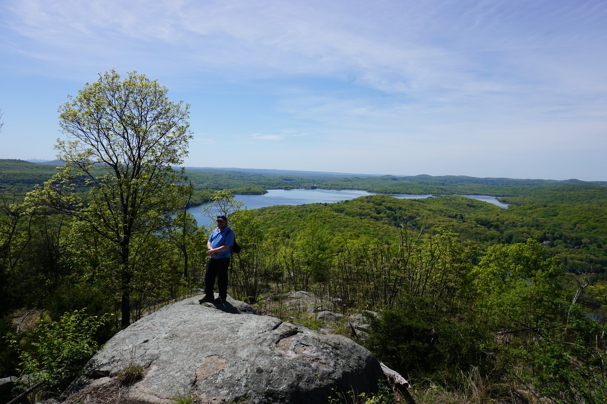
| Windbeam Mnt View |
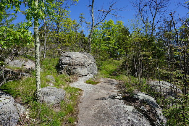 |
| Trail on Windbeam Mountain |
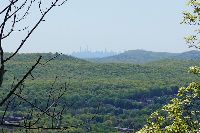 |
| Manhattan Skyline in the Distance |
 |
| Wanaque Reservoir |
 |
| American Flag at Windbeam Mountain Summit |
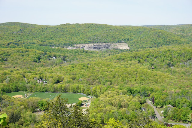 |
| Quarry in the Distance |