Showing posts with label Kakiat park. Show all posts

Sunday, May 11, 2025

Kakiat Upper Ridge Loop

Kakiat County Park /
Harriman State Park
Rockland Co.
New York

Hiking Trails:
Old Mill Trail: Blue blaze
Kakiat Trail: White blaze
Suffern-Bear Mountain Trail: Yellow blaze
Mountain Trail: Orange lazed

Total Time: 2:10 hour
Estimated Distance: 3.8 Miles

Pros: Scenic area, nice climb, waterfalls, and view
Cons: None
Hike Type: Loop
Level of Difficulty: Difficult

Google Maps of Parking:
https://maps.app.goo.gl/SZdPJdTimieU7iEVA

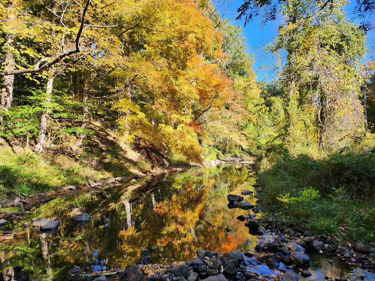
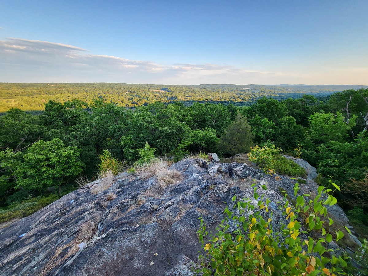
I have been to Kakiat many times, but I rarely make it past the main view at the top of the Mountain Trail. On this hike I decided to go a bit farther to the Suffern-Bear Mountain (SBM) Trail along the very top ridge. I parked in the Kakiat Park parking area, took the Old Mill Trail along the Mahwah River to the Kakiat Trail, and took a short spur to the Kakiat waterfalls. I then continued on the Kakiat Trail up the mountain, past the Mountain Trail, to the SBM Trail.

I took the SMB Trail south, and then bushwhacked at the closest point to the power lines, which I took along the service road back to the Mountain Trail. I took the Mountain Trail to the upper Kakiat view, then climbed down the mountain to the lower view. I then climbed down the rest of the Mountain Trail back to the parking area.

Map of the Route

Mahwah River


Kakiat Waterfalls


Black Rat Snake Crossing the Trail

Kakiat Trail Crossing the Power Lines

Grandma and Grandpa Rocks on the SBM Trail


Crossing the Gas Pipeline

View at the Top of Kakiat Mountain


View from the Kakiat Mountain Lower Summit View

Sunday, October 9, 2022

Kakiat Foothills Fall Hike

Kakiat County Park
Rockland Co.,
New York

Hiking Trails:
Mountain Trail: Orange Blaze
Gas Line Trail: Unblazed
Kakiat Trail: White Blaze
Old Mill Trail: Blue Blaze

Total Time: 0:35 hour
Estimated Distance: 1.5 Miles

Pros: Scenic area
Cons: No climbs or views
Hike Type: Loop
Level of Difficulty: Very easy

Google Maps of Parking:
https://goo.gl/maps/NkxXbLfHSQyV3yc3A

I go to Kakiat fairly frequently, walking around the bottom trails. I generally don't include this in the blog, however, now with the fall foliage and bright blue sky, the colors and scenery were incredible and worthwhile of a blog post. I parked in the Kakiat parking lot, crossed the Mahwah River on the bridge, and took the Mountain Trail to the Gas Line Trail. I then took the Gas Line Trail northward to the Kakiat Trail, which I took to the Old Mill Trail. I inspected the recently demolished concrete at the Old Mill, and then headed back along the Mahwah River back to the trailhead.

Map of the Route

Bridge Crossing the Mahwah River


Mountain Trail at the Kakiat Ascent

Gas Line Trail

End of the Old Mill Trail at the Kakiat Trail

Water Flowing Once Again at the Brook at the Old Mill Trail


Demolished Old Mill


Mahwah River at the Old Mill


Large Rock in the Mahwah River


At the End of the Hike

Thursday, July 14, 2022

Kakiat Lower View Evening Hike

Kakiat County Park
Rockland Co.,
New York

Hiking Trails:
Mountain Trail: Orange Blaze

Total Time: 0:45 hour
Estimated Distance: 1.2 Miles

Pros: Good climb, scenic views
Cons: None
Hike Type: Up and out
Level of Difficulty: Moderate

Google Maps of Parking:
https://goo.gl/maps/NkxXbLfHSQyV3yc3A

Map of the Route

Mahwah River at the Beginning of the Hike

Kakiat Trail and Mountain Trail Junction

Large Timber Rattlesnake on the Mountain Trail


Kakiat Lower Loop View