Rocks State Park
Harford County,
Maryland
Hiking Trails:
White Trail: White blaze
Red Trail: Red blaze
Total Time: 1:05 hour
Estimated Distance: 2.2 Miles
Pros: Cool rock formations, good view, nice river
Cons: Walk on road
Hike Type: Loop
Level of Difficulty: Slightly difficult
Google Maps of Parking:
https://goo.gl/maps/o3totbZR3kRTETsX9
Hiking Partner:
Ari Gunzburg
(Noted keynote speaker - see https://arigunzburg.com)
I was in Baltimore for the weekend, and went with my friend Ari Gunzburg on a great hike 40 minutes north of Baltimore. This was my first time Rocks State Park, which features the King and Queen Seat, a really neat rock formation with a great view. We parked at Deer Creek at the road pull-off parking near the road up the mountain. We took the road for a short distance to the White Trail, which we took to the intersection of the Blue Trail.
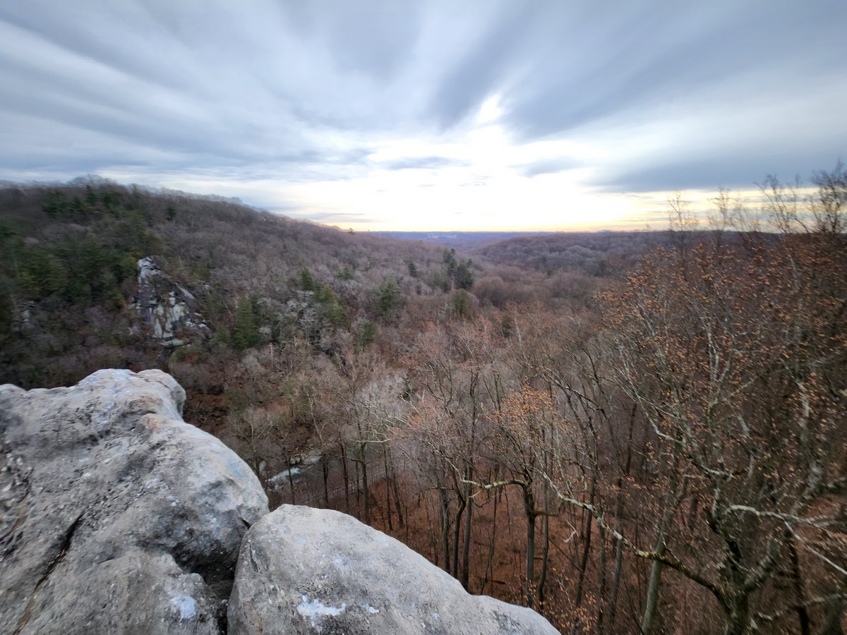
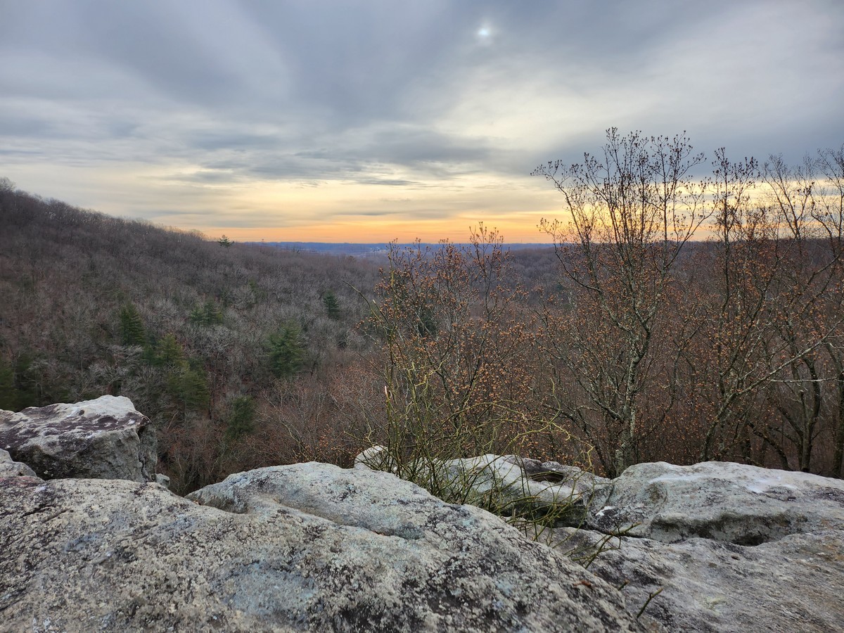
We continued to the White Trail to the top of the mountain, and then to the King and Queen Seat, a really cool rock formation above a sheer cliff over the creek. After taking pictures, we went to the mountain road and walked down the road (which was closed being that it's closed in the early morning.) We then bushwhacked down to the parking area. After this, we drove to Kilgore Falls, in the other section of the park. Stay tuned for that on the next hike!
 |
| Map of the Route |
 |
| Deer Creek |
 |
| Mountain Laurel on the White Path |
 |
| Sign by the Collier Pit, Used for Charcoal |
 |
| Approaching the King & Queen Seat, with a Warning about the Cliff |
 |
| Sign Near the King & Queen Seat |
 |
| Rock Formations at King & Queen Seat |
 |
| Outcrop & View at the King & Queen Seat |
 |
| Deer Creek on the End Run |


No comments:
Post a Comment